After checking out the environs of the Lac Danger camping area (there are a lot of good camping spots here), we continue north along trail SF1. Our next destination is the top of Montagne de Marbre, and we have a fair bit of elevation to gain before getting there. To that end, the trail now starts to climb in earnest.
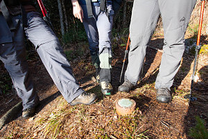
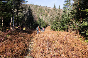
After a short steep stretch, we emerge into a cleared out area the extends uphill and downhill from where we are standing. This is our first look at the border cut: the long continously-cleared strip of land that marks the US-Canada border. This is a curiosity for us - we've never actually walked up to an in-the-wilderness international border before. We soon spot signs posted on the trees at either side of the cut with survey information. The survey signs indicate that an in-ground border survey marker is nearby. Sure enough, there it is: a small steel and concrete post driven nearly flush with the ground. On the end, on a weathered copper disc, is inscribed "CANADA | UNITED STATES". A precise spot through with the international border line between the US and Canada crosses. Cool!
courtesy JInnes
courtesy JInnes
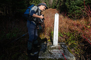
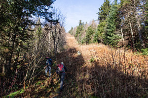
After joking around and taking pictures at the border marker, we continue on up SF1. The trail now runs right up the middle of the border cut, taking advantage of the cleared open terrain. We soon come to an even cooler border marker, this time in the form of a small metal obelisk. Stamped into the sides of this obelisk are names and treaty titles and a date: "August 9th, 1842". One hundred and seventy-nine years ago. Before Canada was even an independent country!
courtesy JInnes
courtesy JInnes
Inspecting the old Marker
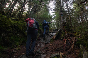
Leaving the doubly-cool antique border marker, trail SF1 angles back into the Canadian side of the forest. The steepness continues, now with a bit of roughness, as we continue to climb this fairly steep aspect of the Montagne de Marbre. The trail climbs in erratic back-and-forth switchbacks, occasionally poking back out into the border cut. It isn't long before we start to get expansive views to the east and south. Although we are exerting ourselves more on this steep stuff, we are glad for it. It reminds us of climbing in the Adirondacks -- a location we day-tripper Canadians have now been unable to visit for nearly two years now.
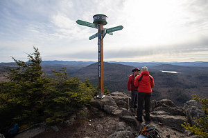
After roughly a thousand feet of climbing, the steep grade starts to ease. We are now approaching the rounded top of the Montagne de Marbre. The vegetation changes to primarily short coniferous forest and there's a lot of pretty green moss about. A side trail leads off left to the an open lookout - today a very windy and cool lookout - over the lands to the south. We are essentially atop the large southern-facing cliff-face of Montagne de Marbre, and the view is expansive. There's also a very modern and fancy summit pole here, with pointers off to the various other summits of the area.
courtesy JInnes
courtesy JInnes
Andrew, Caroline, M. Marbre
Directly down from lookout
The stiff, cold breeze drives us away from this lookout before too long, and we head back into the summit forest and continue on our journey, mentally switching to our next objective: the nearby summit of Mont Saddle.
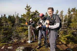
Montagne de Marbre is done yet, however, as after a short few minutes of hiking, we emerge onto another open area and a rocky knob. This appears to be another "summit" of Montagne de Marbre, although not the official one. However, by my GPS it seems to be exactly the same height as the "lookout" summit we were just at.
courtesy JInnes
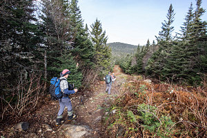
The border cut goes straight over this 2nd summit of Montagne de Marbre and then over to Mont Saddle. Trail SF1 takes advantage of this, and the trail heads north, down the open cut.
courtesy JInnes