Of which virtually no one is unaware, this year's Covid pandemic resulted in a large-scale shutdown of just about everything -- including parks and almost all travel across any borders. As the weeks dragged into months, I had even given some thought of doing an urban solo hike of some sort through my home city of Ottawa; but, fearful of perhaps a backlash to posting what some might consider to be a trip report of me doing something contrary to public health orders, that never happened. Already, our last outing --
a great winter climb of Algonquin's northeast face back in March -- seemed like a long time ago.
courtesy JInnes
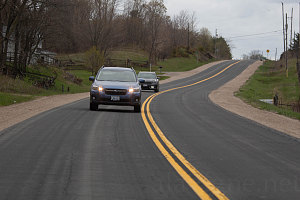
Auto Distancing
Weeks soon morphed into a couple of months. May. True signs of greenery slowly started to emerge in what had been a very cool spring. Although the border to neighboring New York State (and therefore the Adirondacks) remained solidly shut, things started easing in home province of Ontario. On March 11, provincial parks and public spaces were opened again, to limited activities, including hiking. Keen for a respite from the lockdown, the following weekend we picked a spot in Eastern Ontario: a pleasant-looking loop in Frontenac Provincial Park, about 60 kilometres (36 miles) north of the town of Kingston.
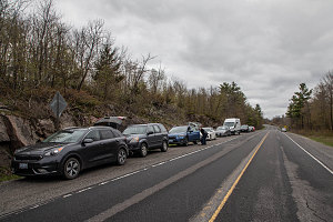
Highway 10 Trailhead
The loop we'd chosen is called the "small Slide Lake Loop". It's a 9 kilometer circuit around a long skinny lake, and reachable from a nearby highway via a 2 kilometer connector trail.
I chose this particular loop for several reasons; one, it was relatively close and accessible to Ottawa; two, none of us had ever done it before; it seemed like less of an obvious route, and so perhaps we could have some measure of solitude, and four, it had trailhead access directly on a highway. That meant we wouldn't have to deal with any gate closure issues -- still a distinct possibility even with the easing of restrictions.
It was a pleasant enough drive through rolling Ontario farm country and into the Frontenac area - a region of low rocky outcrops of bedrock and dotted with innumerable freshwater lakes. The trailhead is a fairly nondescript spot along county road 10 southwest of Perth. I had dreams of a car-less pullout, but we arrived to encounter quite a few cars (perhaps ten) already parked on the side of the road. That really wasn't that bad, though, and odds were that we would encounter light hiker traffic today.
As I said above, you do not immediately start off on the small Slide Lake Loop. First, we had to get to the loop itself, and that meant hiking along a connector trail into the park (this trailhead is not actually within Frontenac Park). The connector trail one uses is actually a small segment of a much longer long-dstance trail (the Rideau Trail) that connects Ottawa to Kingston.
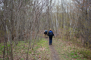
Assuming the proper socially-distant hiking posture, we soon started off down the trail, in the direction of Frontenac Park.
courtesy JInnes
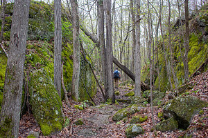
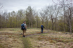
The trail was flat, wide, and smooth, completely obvious and easy to follow. The surrounding forest was fairly open, amplified by the fact that only the tiniest bit of greenery had budded on the trees.
courtesy JInnes
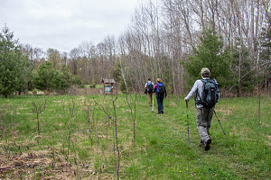
The clear, easy trail was nicely routed through the terrain, passing through cool little hollows and across little forest ledges, avoiding any difficult obstacles. We got a brief taste of some open terrain in a couple of spots, one in the form of a steep little hillock that allowed us a limited view of the surrounding countryside. After about half an hour, we reached the Frontenac Park boundary, and another ten minutes after that, we arrived at a large grassy area, with a prominent sign marking our arrival at the boundary to the Slide Lake area.
From here, trails led off left and right. This was the beginning of our small Slide Lake Loop.
We'd decided to do the loop clockwise, so we headed left. That would get some of the less interesting hiking out of the way first, saving the nicer bits of trail for later on.
courtesy JInnes
courtesy BConnell
courtesy JInnes
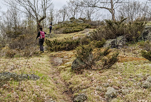
The trail and the terrain were dead flat leading west from the junction. Eventually the terrain got a little more rugged, with little ponds and small changes in elevation. We were encountering groups of people now and then, but overall traffic was light. And, the wide flat trail and open forest meant it was easy to pass other hikers in a socially-distant manner.

courtesy BConnell
Another thirty minutes of easy walking brought us to another intersection of paths - the West Slide Junction. The Rideau Trail continued its journey west towards the center of the park, and a side trail led north towards Slide Lake. The trail leading off to the north was the next leg of our "little" Slide Lake Loop (if you were on the larger loop, you'd continue further west before turning north). This next leg, leading north along the western edge of Slide Lake, was where we would start encountering the supposed "good stuff" -- the highlights -- of this particular route.
courtesy JInnes
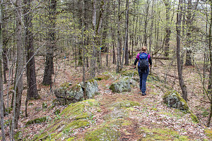
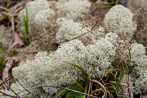
Indeed, the trail was now more interesting. As we headed north, it became rougher (relatively speaking - it was still easy walking) and started climbing up and down onto and off of little ridges - some forested, some bare. Often there would be a small pond or marshland in the low terrain between these ridges. The trail fairly expertly wound its way along the most pleasing bits of the terrain - hitting whatever little highlights there were to be hit.
courtesy JInnes
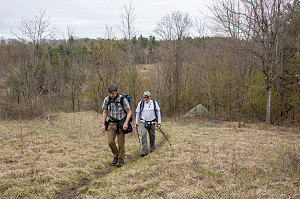
courtesy JInnes
We settled into a comfortable but fairly fast pace - there was nothing particularly difficult in terms of roughness, even when the trail was less than perfect. We had so far encountered no elevation gain or loss of more than perhaps 75 feet, and there was no part of the trail that I would consider truly rough or bouldery. A pretty decent clip was easily possible.
courtesy JInnes
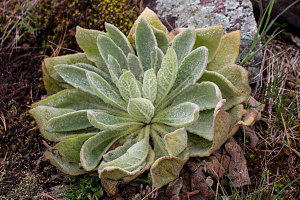
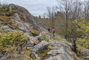
Small overlooks and pretty crags became more frequent and prominent as we continued north. We hadn't yet reached Slide Lake itself, but there was still a lot of pleasant Ontario shield country to see. And it was becoming apparent that this area had a pattern of terrain that was repeating over and over again: long narrow parallel ribs of north-south bedrock separating flats (often marshy or water-filled).
Back up onto ridgey terrain
The terrain continued to gradually get more interesting - the rock ribs got a bit higher, and the views from increasingly open strips of grass or even bare bedrock got better. Eventually we crested a nice high rib of granite that presented us with a first view over Slide Lake. It was about noon at this time, and although there were an increased number of black flies here (we had noticed a few of them while hiking, but here they seemed more numerous and agressive), we stopped for our lunch.
courtesy BConnell