Hello! Welcome to above-the-clouds work hike fall outing #1 for 2019: Pitchoff Ridge.
I lie, however. Fall of 2019 didn't arrive until Monday, September 23rd, and we did this hike on Saturday, September 21. So.... tecccchhhnically, we did this hike in late summer. You be the judge based on the pictures.
Today we had Theresa, Ann, Cheryl, Babneet, Mouhcine, and Deepak. And me.
Freshly Paved Road to the Daks
Pitchoff is an elongated mountain that forms the slopes of the northern side of Cascade Pass (Cascade Mountain forms the southern side) in the Adirondacks. There's a trail that runs most of the length of the long ridgeline, and then descends down to Route 73 at two spots: one just northeast of the pass, where the highway starts to descend, and the other at the soutwestern end of the pass, right across from the Cascade Mountain trailhead.
I chose Pitchoff for our latest above-the-clouds outing because it ticked a number of checkboxes for me / for us: (a) it was a short hike (less than 8km in length), and didn't have too much elevation gain, about 1700-1800 feet, (b) has lots of excellent lookouts in different positions, (c) none of the participating above-the-clouders had ever done it before, (d) it's not crazy busy, and (e) hikes that are not there-and-back are always more enjoyable.

Pitchoff East TH
K, so we've established why we wanted to do Pitchoff. So, how did it go? Well, first off - what a glorious late summer / early fall day! It was warm and calm, perhaps a bit hazy, but not excessively so. We were a bit early on the fall color sequence, but there were still some nice pockets of orange and red on the drive down. We left Ottawa fairly late, and by the time we set up the two cars at either end (remember, we were starting at one point and ending at another), it was past 11 a.m.
We started from the east trailhead, which I believe is the slightly better way to do this traverse, as it saves the best lookout for last, and one could argue that the higher end trailhead saves some impact on the knees on the way down. The east trailhead is also by far the quieter, so you get to ascend up to the ridgeline in solitude. Which was mostly the case for us (we only saw two other hikers).
Ascending through Greenery
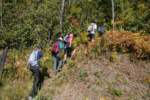
The trail up from the Pitchoff East trailhead to the beginning of the ridgeline portion of the hike is pretty steep, and the elevation gain starts right away from the trailhead; there's no warm-up approach on this one. In combination with the really warm day, we were sweating in no time. A fuzzy caterpiller attacked Theresa, but she was able to fend it off. First-time Adirondacker Babneet found the first bit of exposed rock at the first lookout a bit unnerving, but he started to get over it fairly quickly.
Steeper and more colorful
Approaching First Lookout
The first lookout is indeed glorious - there's a grand panorama south and west towards Keene Valley, and beyond to Vermont. The lookout is on the eastern end of Pitchoff's intermittently-exposed ridgeline, but there's another parallel sliver of exposed bedrock just nearby this point. Normally when hiking this route I don't bother, but today we bushwhacked over to it and got a great view back to the main ridge with the trail.
Cheryl Arriving first lookout
From the first lookout we also got a view along our ridgeline route. The ridgeline is not flat (as one might think when simplistically visualizing a ridge), but rather has a series of bumps, and we could see the first such bump a short way to the southwest of us, with a perhaps 150-foot dip in between.

courtesy DKumar
After the initial excitement and enjoyment of the first lookout had passed, we started our journey along the ridgeline. It is initally over pristine clean bedrock, but soon the ridge starts to reveal its more complex terrain elements. There are small gaps, sharp dropoffs, sloping slabs, and areas of dense trees. The trail is well-marked and clear always, but surmounting, descending, and sometimes lightly scrambling over all of these obstacles is the name of the game for about the first half a mile along the ridge.
Between Slabs and Boulders
Next comes a section that is relatively smooth and has several great lookouts, both to the north and south of the ridge. Typically these are in places where the clean bare bedrock has prevented any vegetation from growing. Towards the end of this section, we stopped for our lunch.
ADK mountains and forests
