Prep Hike 1 - Katie climbs King Mountain
February 2019
In preparation for our upcoming spring 2019 Utah trip, my friend Chris suggested that we take his daughter Katie (who is coming along and doing her first ever backpacking trip with us) on a bit of a test snowshoe hike in Gatineau Park. Sounded like fun. On a mild and sunny Saturday in late February, we did just that.
When I do King Mountain in the winter, I do it "from the bottom" - that is, from the bottom of the Eardley Escarpment, just outside of the park boundary (in fact, you can't easily hike to it from the top, like you can in the summer, because the park's road is closed). In any case, from this lower vantage point, King Mountain presents itself as a legitimate-looking (if still not very high) mountain.
Donning our snowshoes after we cross Chemin de la Montagne, we follow an old closed forest road up into the park, and then soon turn off and follow some faint snowshoe tracks towards the north. The big cliffs on the south side of King Mountain are already visible through the leafless winter forest.
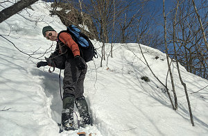
The old snowshoe track I'm on is strangely narrow, which makes for an awkward follow. When we reach the base of the big pink cliffs, we follow a different track - someone with big snowshoes and a big stride - up a snowy slope. This was the start of the real climbing. Katie seemed to be having fun, and we talked about how many "houses" we were above her own not-far-away house.
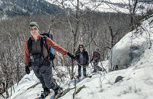
When we climb King Mountain in the winter like this, we aren't following any prescribed path. I generally choose a way up the eastern slopes of the peak, just beyond where the cliffs end. This makes for a fun and short little snow-scramble - nothing overly hard or dangerous, if you pick the right line. I had brought along a bit of fixed accessory cord, and we used it in a spot or two as a simple belay. Katie thought it was fun, and scrambled right up without trouble along with the rest of us.

courtesy JInnes

courtesy JInnes
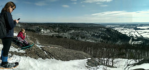
Once past the steepest pitch, it was only about 5 more minutes to the flattening off atop King Mountain, and the first good lookout. We stopped there for a minor snack break and to take in the expansive view to the south and east.

courtesy JInnes
The hike across the open crest on King Mountain is the easiest and most scenic part of this short hike, with mostly flat walking and nice views that progress from east to south and then to west, looking up along the Eardley Escarpment.
Next up, the descent. Usually I chart a course through the increasingly dense forest to the west, looking for moderate slopes that will allow an easy descent back to the completion of the loop portion of the route. Today, however, we were following the big-strided snowshoer's tracks, and these tracks went downhill quite a bit sooner than I usually choose myself. We didn't see any re-ascent tracks, so we figured that the snowshoer had found a reasonable way down, and we decided to follow.
As it turns out, the mysterious snowshoer had chosen to head down a gully that was fairly steep - certainly steeper than anything we had done on the way up. We gave it a once-over, deciding that we should probably be able to manage it, even though we couldn't really see a clear route all the way to the bottom from our vantage point at the top.
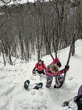
Out came the hand-line again, and this time, it really did prove quite useful. I belayed everyone down the first inital steep part of the gully, then used it as a way to do a simple rappel for myself.
That wasn't it, though - there were additional steep bits with undetermined hazards below, so again we proceeded with caution and used the hand-line in several places. It became a fairly slow descent as a result. One important point to note, though - Katie was cheerful and careful the whole way down. I was impressed.

courtesy JInnes
Our unexpected spicy descent was much slower than if we had just continued a little way further west - but on the other hand, it was kind of fun and certainly turned this simple little hike into a more difficult test - and it had all gone quite well (well, apart from the fact that one of my MSR Lightning Ascent snowshoe binding plates broke.... that'll have to get fixed).
Once down at the bottom of the gully, a short bit of trail-breaking brought us to our ascent track, and from there, it was only a 10-minute walk back to the trailhead. Well done. Really well done!
Chemin de la Montagne in sight
Interactive trackmap with photo points - King Mtn Hike - click map to view
King Mountain - Hike Data
Start Time:
11:34a.m.
End Time:
3:17p.m.
Duration:
3h43m
Distance:
2.39 km
(1.49 mi)
Average Speed:
0.6 km/hr
(0.4 mph)
Start Elevation:
500ft
(152m)
*
Max Elevation:
1068ft
(325m)
*
Min Elevation:
393ft
(120m)
*
End Elevation:
393ft
(120m)
*
* : +/- 75 feet
Total Elevation Gain:
556ft
(169m)
*
Total Elevation Loss:
664ft
(202m)
*
* : +/- 75 feet
Elevation Graph