The start of Allen Brook marks the start of the steep stuff - the "real" part of the ascent of Allen. From this point, at about the 2650-foot level, the herdpath follows the very steep gradient of Allen Brook directly up to the summit ridgeline at 4250 feet. That's about 1600 feet of gain over a distance of about 1.25km (0.8mi).
We began our attack on Allen Brook, climbing up steep roots and alongside the little cascades of the watercourse. As we climbed higher, small patches of open bedrock presented themselves, sometimes wet with the runoff from the brook, sometimes a bit off to the side and drier. It is actually a reasonably fun little climb, not exposed but still requiring a bit of scrambling skill.
At about the 3600-foot level, Allen Brook ceases to be a distinct entity and fades into the upper slopes of the mountain. The bedrock slabs here are wider and steeper, and today, streaked with dampness. The more open rock started to provide some nice views back to the north, and we stopped to take in the first truly good mountain views of the day.
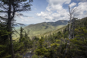
Finally, some views
At the base of a particularly wide section of bedrock, five of us decided to stay along the right-hand edge rather than cross over (Kellen and Kevin decided to cross over). The smaller party turned out to have gotten it right; us five had an unpleasant time following a very faint, mostly-bushwhack course to the summit ridgeline. By the time we realized we were off the main herdpath, we were too high and did not want to give up the elevation we had gained. We perservered, turning left and eventually re-joining the main herdpath about a hundred metres (yards) before the actual summit. I've marked this off-course section in yellow on my interactive trackmap - if you are climbing Allen yourself, try to avoid this.
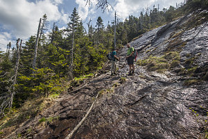
Cross here
Kellen and Kevin were lounging beneath Allen's summit sign as the rest of us arrived. We had made it - five hours and fifteen minutes after setting out from the Upper Works Road.
Allen's actual summit is very non-descript - a brown sign nailed to a tree in a patch of forest. Fortunately, just a few seconds' walk to the north there is an opening in the trees that gives one a very nice vantage point of the Central High Peaks - Marcy, Skylight, Haystack, Gothics - from an unusual southern angle. If the weather is good, this provides the best view of the entire journey.
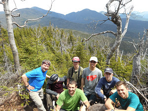
courtesy MFleming
After a good, long summit lunch break, we began our long journey back. That's one of the challenging things about Allen - you have just walked a very long distance with not that many views to get here, and now you must retrace every one of your [mostly viewless] steps back to the trailhead, except now your feet might be getting a bit sore. Character-building, Allen is.
Taking care to choose the correct herdpath on the way down, we quickly descended to the upper slabs, then began a careful descent down along Allen Brook. The dampness and steepness of the bedrock requires some care on descent, especially in the areas where a sort of reddish lichen or moss has grown on the rock (Grant calls this stuff pink slime).
Our hot, long hike was taking a toll on our water reserves, and when we finally completed the steep descent of Allen Brook, we stopped to filter additional litres of water.
Somewhat remarkably, it had been a relatively bug-free day. Normally the end of May and beginning of June are horrible for bugs in the Adirondacks, but today I had not even bothered once to apply bug repellant (and I had received perhaps a bite or two). Very likely the dry spring / low water and the lack of bugs were correlated.
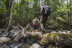
Back across Skylight
Finished with the Allen Brook portion, the herdpath immediately became less steep, and we resumed normal hiking (rather than what had essentially been a semi downscramble). This meant a much increased hiking pace, and we arrived back at Skylight Brook in no time. On the other side, we began a moderate climb back up to the low shoulder of Redfield, where we stopped for our next break.
Unofficial but maintained
The length of the hike was starting to wear at us as we continued on, and we were glad when the landmarks of our hike in were passed, one by one: the gravel pit, the re-joining with maintained trail, the end of the logged area. By the time we got to the Opalescent River, we were out of water again and getting pretty overheated from what had become an oppressively hot afternoon. Fortunately, rivers are wet and cool, and we stopped for a nice long soak break. I pumped another litre of cool, fresh water out of the river.
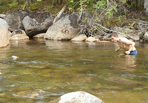
courtesy MFleming
Kellen's Freshness Experience
With our temperatures lowered and spirits raised, we continued on after our Opalescent River rest stop. The rest of the way was almost entirely flat and straightforward, and the remaining distance had dwindled to a point where we could convince ourselves that the end of our tiring trek was a near thing.
More landmarks came and went with satisying regularity - the end of the Opalescent walk; the sighting of Lake Sally; the completion of the last annoying muddy section; the old cabins. Soon Lake Jimmy was in sight, and after completing the re-route around the north end, we knew we were really close. I quickly marched to the front of the group to get some hero arrival shots.
Shortly after 5pm, we were done - it had been just under eleven hours in total, with total distance a shade under 30km. A pretty rapid pace by my reckoning. Really good job, guys. Especially for Phong, for whom Mt Allen was his second-ever Adirondack hike. Way to go getting one of the harder, less scenic ones out of the way!
While Grant, Murray and Dennis went off to Newcomb's town bar to procure some beer, the rest of us stopped for some cold roadside dairy on the way back to the campground. Back at camp, we had a relaxing (and amazingly bug-free) evening.
The next morning, after Grant and I did a quick hike up nearby
Goodnow Mountain, we visited the town beach, then shook hands and parted ways for the weekend.
I'd like to thank Grant for organizing the Allen hike. I can honestly say I wouldn't have bothered to go back up this peak on my own volition, but I'm glad I joined this trip. Definitely great meeting the group, too. Everyone was a strong hiker on this outing.
If you'd like to read about our Goodnow Mountain climb, please click
here.
Interactive trackmap with photo points - Allen Mountain - click map to view
Allen Mountain - Hike Data
Start Time:
6:15a.m.
End Time:
5:12p.m.
Duration:
10h56m
Distance:
29.62 km
(18.41 mi)
Average Speed:
2.7 km/hr
(1.7 mph)
Start Elevation:
1791ft
(546m)
*
Max Elevation:
4319ft
(1316m)
*
Min Elevation:
1691ft
(516m)
*
End Elevation:
1723ft
(525m)
*
* : +/- 75 feet
Total Elevation Gain:
3167ft
(965m)
*
Total Elevation Loss:
3231ft
(985m)
*
* : +/- 75 feet
Elevation Graph
