Well, well, well... look what I found myself doing this past weekend: good ol' Allen Mountain - one of the ADK peaks everyone likes to slam. Although not completely without merit, Allen requires a certain amount of patience and fortitude. Its been a while since I've tackled its distant, somewhat nondescript slopes.
So, what made me climb Mt Allen on this - an early-season scorcher of a weekend at the end of May? The Alpine Club of Canada did. More specifically, one of the ACC's group hiking outings. I've been a member of the club for quite a while, but my participation level in club events has been minimal. I was looking to change that, and it just so happened that the next major hiking outing on the agenda was Allen Mountain.
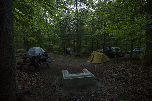
Lake Harris CG
Unlike my usual down-and-back in a day routine, this ACC-organized trip spanned the full weekend. Trip leader Grant had booked us into three campsites at the Lake Harris State Park campground. Located just outside of the very small hamlet of Newcomb, NY, it provided us with a cheap place to stay that was 20 minutes drive from the trailhead.
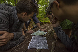
Understanding the challenge
A climb of Allen Mountain is - more than anything else - long. It isn't that the mountain itself is especially high or rugged by Adirondack standards; rather, it's length and difficulty stem primarily from the fact that there is no publicly-accessible trailhead that is close to the mountain. One must trudge in a long way on the flat until one reaches the base of the 4340-foot peak.
Allen is one of the so-called "trailless" mountains of the Adirondacks. Being one of the 46R peaks, though, a fairly distinct herdpath route has developed on Allen. Although routefinding can be a slight issue at times, if one does a bit of pre-trip research and keeps one's eyes peeled, it isn't too hard to stay on track.
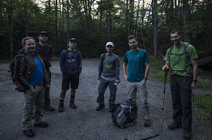
Allen Trailhead
Before I recount the hike itself, let me introduce the attendees. There were seven of us in all: Murray, Kevin, Kellen, Dennis, Phong, myself, and trip leader Grant.
Our stay in the Lake Harris Campground allowed us to arrive at the trailhead (located about a kilometre south of the end of the Upper Works road) at a pretty decent 6 a.m.
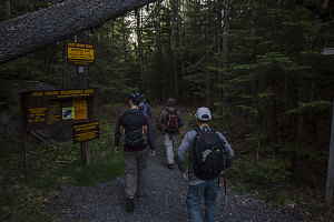
Setting Out
It was already quite warm (perhaps 18 degrees / 64F) by the time we were prepped and ready to go at 6:15 a.m. The forecast for the whole weekend was hot and muggy - unseasonably so for late May. On the bright side, it was forecast to be relatively calm, with a low chance of rain or thunderstorms.
Trip leader Grant set off at a very brisk pace. A quick stop to secure a loose water shoe on my pack resulted in a big gap that I had to half-run to make up in a reasonable time. The tone for this hike was becoming apparent : a no-nonsense, no-dally takedown of Allen Mountain.
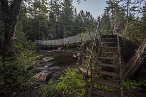
Hudson Crossing
In very short order we came to the metal suspension bridge crossing of the Hudson River. Only a moderate stream at this point, there's no indication here that this watercourse grows into New York State's most prominent river.
A third of a mile beyond and we came to Lake Jimmy. There used to be a long floating hiker causeway that lay across the upper arm of this Lake. It had gradually deteriorated to the point where the NYSDEC decided to abandon it and create a permanent re-route around the north end of the Lake. Fresh flagging and tread marked this spot. It was well-marked and had good bridging and planking where needed. Although this new section of trail adds about 1/3 to 1/2 of a kilometre of extra hiking distance, it will no longer be prone to the failures that plagued the former causeway. In the deep of winter, of course, the old original route can be taken.
Beyond Lake Jimmy, the trail led up a small rise, and we soon reached the semi-open clearing containing several old run-down cabins. One of these cabins seemed to have been fixed up (sometime in the last eight or so years) and is now in pretty solid shape. We stopped briefly for a water break and to inspect.
At the old cabins, the approach route bends to the right (to the south), following a wide and grassy old roadbed. Very shortly we came to the junction with the side trail leading up to the top of Mt Adams, one of the Adirondack's fire tower peaks. Continuing on, the trail undulated slightly up and down, angling south towards the Opalescent River and the old Tahawus Mine. We maintained a rapid and constant pace.
Not all peaches and cream
Before actually reaching the Tahawus mine site, the marked trail veers sharply off to the left. This section of trail roughly parallels the eastern shore of Lake Sally, which could occasionally be seen through the trees on our right. In general, this section of trail was connecting us over to the banks of the Opalescent River, where we would begin the next phase of our approach to Allen. Notably, this section of trail had a few nasty mud sections, which will probably be dried out by mid-summer.
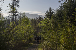
North River Mountains
Owing to our excellent pace, we completed the hike to the banks of the Opalescent by 7:20 a.m. - a mere 65 minutes after starting the hike. Not skipping a beat, Grant kept us marching on, now on an old road-bed that closely parallels the river's western bank.
Our route now bent back east as we followed the Opalescent. The old road-bed allowed continued rapid progress, and soon we arrived at the designated crossing point over the river. Currently (as of spring 2016) the bridge over the Opalescent is gone (destroyed with the storms of recent years), and we were going to have to cross without any sort of aid. In anticipation of this, Grant had recommended that we bring water shoes for the crossing. (Note: the NYSDEC is rebuilding this bridge and should have it complete by the end of September 2016).
Parallelling the Opalescent
Fortunately for us, the spring of 2016 had been remarkably dry, and the water levels in the Opalescent (which is a major watercourse that can have a high, fast, and wide flow) were exceptionally low. In fact, they were so low that we managed to find a viable rock-hopping route - water shoes not required.
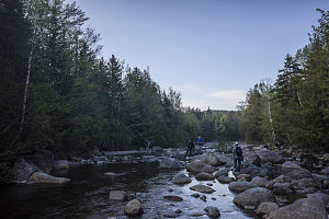
Super-low water
Beyond the crossing of the Opalescent, the signed trail continued in a northeasterly direction. I used to refer to this section as the "open" logged area. Back in the early 2000s, a multi-kilometre stretch of land here was logged, and in my previous hikes of Allen in 2003 and 2008, it was a wide open wasteland. Now, however, it had started to grow back in earnest, and a vibrant young forest had mostly closed off the open views. On the plus side, the trail through this section was now a very pleasant little earthy footpath through a still-grassy forest floor.
At a quarter past eight, only two hours after starting out, we arrived at the end of official trail - for us, that is. At a small clearing with a huge and crudely carved "Marcy" sign, the official trail bends off to the left to continue north towards Flowed Lands. This was the start of the unofficial, un-marked section of the route leading to Allen. After the rapid pace of the last two hours and with the day's heat becoming increasingly felt, we stopped for a much-needed food and water break here.
Continuing on, we headed east on the un-marked but clearly visible path. Fifteen minutes' worth of walking brought us to an active gravel road (no public access), where we turned left and walked for about 10 seconds until we reached a grassy / sandy open space on the right. This was the site of an old gravel pit, and it marked the start of the next phase of our Allen climb. At the far end of the gravel pit stood an NYSDEC trail register. Clearly the state wanted to know who was climbing Allen, even if the way wasn't officially maintained.
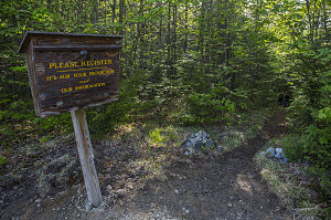
Official Register on Unofficial Trail
After signing us in to the register, Grant led us onward, and we plunged back into forest. We finally now started to climb upwards (up to this point - a full nine kilometres in from the trailhead, it had been essentially flat and we had gained no meaningful elevation towards our goal).
The herdpath was fairly obvious as it led up the lower flanks of Mt Redfield (the route to Allen skirts the southern flanks of Mt Refield, another 46R peak), but there were a number of faint old logging roads that could lead you astray if you weren't careful. In the summertime, the obvious signs of foot traffic should keep you on course.
After climbing up about 500 feet, the herdpath led through a shallow height of land and then descended a couple of hundred feet back down to cross a couple of brooks - the larger of which is Skylight Brook. This can be slightly tricky to cross at high water, but today (like everywhere else), the flow was extremely low, and hopping across was trivial.
On the far side of Skylight Brook, the herdpath turns sharp left, and begins a traversing rise in the forest south of Skylight Brook. The herdpath is well-defined here, and it is obvious when you are on it. This sharp left turn also marks the start of the "real" ascent up Allen. You are on Allen Mountain's slopes at this point, and every foot of elevation gained from now on counts directly against your summit objective.
Half an hour and 350 feet of moderate incline brought us to a smaller brook, coursing in a small gorge down Allen Mountain's western slopes. A small cascade and a shady cliff marked a pleasant spot to stop.
This small brook, called Allen Brook, would be our companion for most of the remaining way up to the top - the herdpath follows the course of the brook until it peters out.
