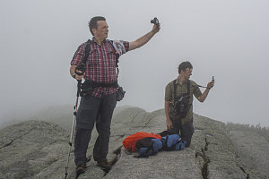
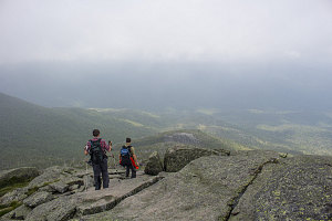
We spent a bit of time fooling around on the summit, quite enjoying the blustery but comfortable (and sweat-drying) conditions. I briefly used my phone to check the weather radar, which revealed that no major bad weather - in fact no rain at all, was anywhere in the vicinity of the central High Peaks. It was looking like the 15-20 minutes of rain at 9am was going to be all that we'd be experiencing today.

courtesy JInnes
Feels stronger than the number
Our descent was unremarkable and pretty much as expected: nice and enjoyable from the summit down to the Algonquin trail junction, then annoying and tedious down to about the 2500-level, then nice and easy all the way back to the trailhead.

courtesy JInnes
Given our fairly early start, our decent pace, and the relatively short itinerary, we arrived back at the parking lot at quite an early time, ten minutes before 1pm. The clouds had become less and less solid as we descended, and by the time we had arrived back at the trailhead, the skies were well over 50% clear. It looked like most of the day in the Adirondacks was actually going to be quite decent (if still a bit sticky).
In retrospect, we probably could have safely tacked the slide route up Grace, but given the uncertainty in the forecast, our choice had still been the "Wright" one. And, sticky humidity and rough trail bits notwithstanding, it had still been a quite enjoyable climb.
Interactive trackmap with photo points - Wright Peak - click map to view
Wright Peak Climb - Hike Data
Start Time:
7:43a.m.
End Time:
12:50p.m.
Duration:
5h6m
Distance:
11.52 km
(7.16 mi)
Average Speed:
2.3 km/hr
(1.4 mph)
Start Elevation:
2216ft
(675m)
*
Max Elevation:
4630ft
(1411m)
*
Min Elevation:
2155ft
(657m)
*
End Elevation:
2248ft
(685m)
*
* : +/- 75 feet
Total Elevation Gain:
2527ft
(770m)
*
Total Elevation Loss:
2526ft
(770m)
*
* : +/- 75 feet
Elevation Graph
