There were no dramatic weather events overnight. It was calm, although cooler and more moist than it had been the previous night. A passing shower or a period of light drizzle marked the early morning hours, and by the time we got up, low cloud and mist obscured the far end of the lake. The cool temperatures from late last evening continued; it was perhaps only 12 or so degrees celcius.
Despite the damp conditions, Arn and Dave managed to get the fire going strongly again, and soon we had bits of breakfast sizzling over open flames. Jenn and I had some pancakes topped with some delicious backyard UMEX Silver Syrup (tm).
For today (Sunday), our objective was to journey back to the parking lot at Shall Lake. From here on Godda Lake - the hydrographic apex of our trip - we would follow the water drainage down to where it emptied into Booth Lake. There was only one portage to make - a 500 metre-ish land journey between Godda Lake and Mole Lake. From Mole Lake, we would follow the navigable waters of McCarthy Creek down into Booth Lake.
Nel (Arn and Gosia's daughter) had been practicing canoeing skills at every opportunity just outside our camps. Today she was very keen to try her hand (with us in our canoe) at the all-important stern position. Initially we brushed her off, but the more I thought about it, the more I thought that the first bit of paddling today (a short and straightforward 800-metre paddle to the first portage) might be a good time for her to give it a shot. I consulted with Arn and he gave it his ok.
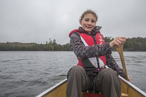
Capitan Nel
Nel happily took her new spot in the back of the canoe (with me in the center and Jenn in the front), and off we went, across the gloomy, misty lake.
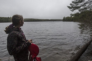
Waiting for others
Despite some back and forth weaving, we generally headed in the right direction, and twenty minutes later, we docked at the start of the Godda-Mole portage. We had to wait an unexpectedly long time for the other canoes to come into view, and, as they finally approached, we knew why. Each canoe had a first-timer at the stern; apparently my example of letting Nel pilot the canoe had had a cascading effect!
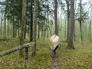
courtesy Jinnes
The Godda Lake - Mole Lake portage was a relatively pleasant affair as portages go. In addition to being a modest 500-ish metres in length, the footing was good the whole way, without boggy, narrow, or bushy sections, was mostly downhill, and wound through several very attractive stretches of forest.
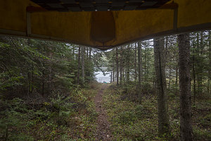
Mole Lake Ahead
We arrived at Mole Lake shortly after 11:30 a.m. Next up was a very long continuous section of paddling, down the McCarthy River to Booth Lake, and then across Booth Lake to the Booth Lake Dam - over seven kilometres' worth of paddling away. We resumed our normal positions (ie kids in the middle) for this stretch.
After crossing the modest dimensions of Mole Lake, we entered McCarthy Creek - a relatively wide watercourse often bordered by extensive wetland. As a result, there's a fair amount of beaver activity. We soon encountered some of this activity, in the form of a river-wide section of scattered logs and debris. It looked like a tricky haul over several logs, but Arn and Gosia spotted a potential narrow passageway on the far left. We investigated and found that we could indeed slide through here, although some shallow water over mud and debris did force us to physically slide the canoe a metre or two.
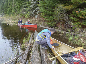
courtesy Jinnes
Dave had chosen a different path to the right, and encountered more difficult obstacles, including several logs that needed to be surmounted. Eventually, however, we all made it through successfully, and we continued our journey down placid McCarthy Creek, winding through several pretty sections of bog.
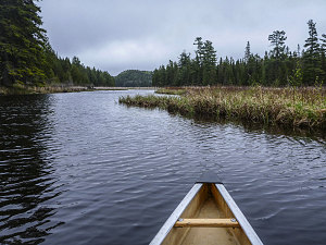
courtesy Jinnes
Even though a slight breeze blew against us, we made decent time (probably due to the slight current in McCarthy creek offsetting the breeze). The creek widened and narrowed as we paddled along, almost always bordered by wetlands throughout its length. The creek gradually bent northward as we progressed, and finally we arrived at a southwestern arm of Booth Lake at about 1pm. The weather remained cloudy and cool, but generally dry.
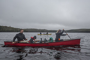
Back across Booth
We had been slightly concerned about the water conditions across the much larger and more open waters of Booth Lake, but the northern breeze did not do much more than raise a few moderate ripples on the lake, even along its widest section. We crossed eastward without incident, merging with our outbound path from the day before (and therefore completing the 'loop' section of our journey). We arrived at the Booth Lake dam at about 1:20 pm. We hauled the boats onshore and stopped here for lunch.
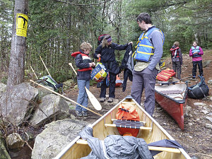
courtesy Jinnes
Booth Lake Dam take-out point
After completing the portage around the dam and down to Kitty Lake (or, to be more precise, the short bit of Opeongo River immediately above Kitty Lake), we set in for the final paddle back to the parking lot. At the far end of Kitty Lake, we had our only run down any sort of moving water - the short bit of rapids along the Opeongo from Kitty to Farm Lake (this was the small rapid that Arn and Gosia had powered up on the way in). It was not at all difficult, but still - a bit of extra enjoyment.
It drizzled on and off as we paddled back across Kitty Lake, past our first night's campsite on the Opeongo River, and back into Farm Lake. We pulled up to the launch point at the Shall Lake Parking lot shortly before 4pm - perhaps a tad later than we had predicted, but still basically as planned. The cool and dreary weather wasn't particularly appealing, so it was kind of nice to be done for the day.
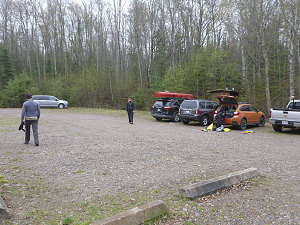
courtesy Jinnes
Arn and Dave graciously returned the two rental canoes, and the rest of us packed up the vehicles. We headed back to the outfitter store at the intersection with highway 60, where we returned the rest of the rental equipment, then started the drive back to Ottawa, where Arn and Gosia generously hosted a post-trip pizza dinner at their place.
So... another successful canoe trip under our newbie belts (the third for myself and Jenn). This was a short but still enjoyable outing; the excitement of the storm and the wide variation in conditions (summerlike for the first half, damp and springlike for the second half) made for an interesting experience. We both appreciated being invited, and for all of the extra work that both Arn and Dave did for us (rentals handled for us, various camp activities - fire setup, food hanging, wood gathering and prep, etc). Thank you once again.
Interactive trackmap with photo points - Godda Lake Loop - click map to view
Farm Lake
(Track color: )
Start Time:
6:30p.m.
End Time:
7:06p.m.
Duration:
0h36m
Distance:
3.18 km
(1.98 mi)
Average Speed:
5.3 km/hr
(3.3 mph)
Start Elevation:
1290ft
(393m)
*
Max Elevation:
1306ft
(398m)
*
Min Elevation:
1278ft
(389m)
*
End Elevation:
1289ft
(393m)
*
* : +/- 75 feet
Total Elevation Gain:
13ft
(4m)
*
Total Elevation Loss:
12ft
(4m)
*
* : +/- 75 feet
Opeongo River
(Track color: )
Start Time:
9:40a.m.
End Time:
9:52a.m.
Duration:
0h11m
Distance:
0.36 km
(0.23 mi)
Average Speed:
2.0 km/hr
(1.2 mph)
Start Elevation:
1270ft
(387m)
*
Max Elevation:
1276ft
(389m)
*
Min Elevation:
1270ft
(387m)
*
End Elevation:
1273ft
(388m)
*
* : +/- 75 feet
Total Elevation Gain:
0ft
(0m)
*
Total Elevation Loss:
1ft
(0m)
*
* : +/- 75 feet
Farm-Kitty Portage
(Track color: )
Start Time:
9:53a.m.
End Time:
9:58a.m.
Duration:
0h5m
Distance:
0.1 km
(0.06 mi)
Average Speed:
1.2 km/hr
(0.7 mph)
Start Elevation:
1278ft
(389m)
*
Max Elevation:
1290ft
(393m)
*
Min Elevation:
1276ft
(389m)
*
End Elevation:
1278ft
(389m)
*
* : +/- 75 feet
Total Elevation Gain:
2ft
(1m)
*
Total Elevation Loss:
1ft
(0m)
*
* : +/- 75 feet
Kitty Lake
(Track color: )
Start Time:
10:01a.m.
End Time:
10:26a.m.
Duration:
0h24m
Distance:
1.39 km
(0.87 mi)
Average Speed:
3.5 km/hr
(2.2 mph)
Start Elevation:
1278ft
(389m)
*
Max Elevation:
1292ft
(394m)
*
Min Elevation:
1267ft
(386m)
*
End Elevation:
1283ft
(391m)
*
* : +/- 75 feet
Total Elevation Gain:
6ft
(2m)
*
Total Elevation Loss:
4ft
(1m)
*
* : +/- 75 feet
Kitty-Booth Portage
(Track color: )
Start Time:
10:31a.m.
End Time:
10:49a.m.
Duration:
0h18m
Distance:
0.63 km
(0.39 mi)
Average Speed:
2.1 km/hr
(1.3 mph)
Start Elevation:
1287ft
(392m)
*
Max Elevation:
1328ft
(405m)
*
Min Elevation:
1287ft
(392m)
*
End Elevation:
1303ft
(397m)
*
* : +/- 75 feet
Total Elevation Gain:
22ft
(7m)
*
Total Elevation Loss:
6ft
(2m)
*
* : +/- 75 feet
Booth Lake
(Track color: )
Start Time:
10:50a.m.
End Time:
11:35a.m.
Duration:
0h45m
Distance:
3.36 km
(2.09 mi)
Average Speed:
4.5 km/hr
(2.8 mph)
Start Elevation:
1301ft
(397m)
*
Max Elevation:
1313ft
(400m)
*
Min Elevation:
1260ft
(384m)
*
End Elevation:
1313ft
(400m)
*
* : +/- 75 feet
Total Elevation Gain:
27ft
(8m)
*
Total Elevation Loss:
27ft
(8m)
*
* : +/- 75 feet
Booth-Ryegrass Portage
(Track color: )
Start Time:
11:40a.m.
End Time:
11:47a.m.
Duration:
0h7m
Distance:
0.35 km
(0.22 mi)
Average Speed:
3.0 km/hr
(1.9 mph)
Start Elevation:
1309ft
(399m)
*
Max Elevation:
1354ft
(413m)
*
Min Elevation:
1305ft
(398m)
*
End Elevation:
1354ft
(413m)
*
* : +/- 75 feet
Total Elevation Gain:
34ft
(10m)
*
Total Elevation Loss:
0ft
(0m)
*
* : +/- 75 feet
Ryegrass Lake
(Track color: )
Start Time:
11:50a.m.
End Time:
12:17p.m.
Duration:
0h27m
Distance:
0.54 km
(0.33 mi)
Average Speed:
1.2 km/hr
(0.7 mph)
Start Elevation:
1349ft
(411m)
*
Max Elevation:
1363ft
(415m)
*
Min Elevation:
1349ft
(411m)
*
End Elevation:
1360ft
(414m)
*
* : +/- 75 feet
Total Elevation Gain:
4ft
(1m)
*
Total Elevation Loss:
1ft
(0m)
*
* : +/- 75 feet
Ryegrass-Rumley Portage
(Track color: )
Start Time:
12:18p.m.
End Time:
12:35p.m.
Duration:
0h17m
Distance:
0.53 km
(0.33 mi)
Average Speed:
1.9 km/hr
(1.2 mph)
Start Elevation:
1363ft
(415m)
*
Max Elevation:
1439ft
(438m)
*
Min Elevation:
1355ft
(413m)
*
End Elevation:
1398ft
(426m)
*
* : +/- 75 feet
Total Elevation Gain:
54ft
(16m)
*
Total Elevation Loss:
1ft
(0m)
*
* : +/- 75 feet
Rumley Lake
(Track color: )
Start Time:
1:14p.m.
End Time:
1:33p.m.
Duration:
0h19m
Distance:
0.7 km
(0.43 mi)
Average Speed:
2.2 km/hr
(1.4 mph)
Start Elevation:
1374ft
(419m)
*
Max Elevation:
1387ft
(423m)
*
Min Elevation:
1363ft
(415m)
*
End Elevation:
1383ft
(422m)
*
* : +/- 75 feet
Total Elevation Gain:
9ft
(3m)
*
Total Elevation Loss:
1ft
(0m)
*
* : +/- 75 feet
Rumley-Godda Portage
(Track color: )
Start Time:
1:34p.m.
End Time:
2:04p.m.
Duration:
0h30m
Distance:
1.39 km
(0.86 mi)
Average Speed:
2.8 km/hr
(1.7 mph)
Start Elevation:
1382ft
(421m)
*
Max Elevation:
1466ft
(447m)
*
Min Elevation:
1380ft
(421m)
*
End Elevation:
1420ft
(433m)
*
* : +/- 75 feet
Total Elevation Gain:
51ft
(16m)
*
Total Elevation Loss:
27ft
(8m)
*
* : +/- 75 feet
Godda Lake 1
(Track color: )
Start Time:
2:09p.m.
End Time:
2:14p.m.
Duration:
0h4m
Distance:
0.13 km
(0.08 mi)
Average Speed:
1.9 km/hr
(1.2 mph)
Start Elevation:
1417ft
(432m)
*
Max Elevation:
1431ft
(436m)
*
Min Elevation:
1391ft
(424m)
*
End Elevation:
1413ft
(431m)
*
* : +/- 75 feet
Total Elevation Gain:
3ft
(1m)
*
Total Elevation Loss:
4ft
(1m)
*
* : +/- 75 feet
Godda Lake 2
(Track color: )
Start Time:
10:43a.m.
End Time:
11:00a.m.
Duration:
0h16m
Distance:
1.06 km
(0.66 mi)
Average Speed:
4.0 km/hr
(2.5 mph)
Start Elevation:
1391ft
(424m)
*
Max Elevation:
1399ft
(426m)
*
Min Elevation:
1382ft
(421m)
*
End Elevation:
1382ft
(421m)
*
* : +/- 75 feet
Total Elevation Gain:
0ft
(0m)
*
Total Elevation Loss:
10ft
(3m)
*
* : +/- 75 feet
Godda-Mole Portage
(Track color: )
Start Time:
11:11a.m.
End Time:
11:30a.m.
Duration:
0h19m
Distance:
0.71 km
(0.44 mi)
Average Speed:
2.2 km/hr
(1.4 mph)
Start Elevation:
1396ft
(426m)
*
Max Elevation:
1461ft
(445m)
*
Min Elevation:
1292ft
(394m)
*
End Elevation:
1292ft
(394m)
*
* : +/- 75 feet
Total Elevation Gain:
13ft
(4m)
*
Total Elevation Loss:
120ft
(37m)
*
* : +/- 75 feet
McCarthy-Booth
(Track color: )
Start Time:
11:37a.m.
End Time:
1:23p.m.
Duration:
1h46m
Distance:
7.21 km
(4.48 mi)
Average Speed:
4.1 km/hr
(2.5 mph)
Start Elevation:
1286ft
(392m)
*
Max Elevation:
1295ft
(395m)
*
Min Elevation:
1270ft
(387m)
*
End Elevation:
1286ft
(392m)
*
* : +/- 75 feet
Total Elevation Gain:
15ft
(5m)
*
Total Elevation Loss:
22ft
(7m)
*
* : +/- 75 feet
Booth-Kitty Portage
(Track color: )
Start Time:
2:22p.m.
End Time:
2:33p.m.
Duration:
0h10m
Distance:
0.62 km
(0.39 mi)
Average Speed:
3.7 km/hr
(2.3 mph)
Start Elevation:
1313ft
(400m)
*
Max Elevation:
1320ft
(402m)
*
Min Elevation:
1284ft
(391m)
*
End Elevation:
1284ft
(391m)
*
* : +/- 75 feet
Total Elevation Gain:
0ft
(0m)
*
Total Elevation Loss:
25ft
(8m)
*
* : +/- 75 feet
Opeongo-Kitty-Farm
(Track color: )
Start Time:
2:33p.m.
End Time:
3:44p.m.
Duration:
1h10m
Distance:
5.03 km
(3.12 mi)
Average Speed:
4.3 km/hr
(2.7 mph)
Start Elevation:
1286ft
(392m)
*
Max Elevation:
1295ft
(395m)
*
Min Elevation:
1254ft
(382m)
*
End Elevation:
1278ft
(389m)
*
* : +/- 75 feet
Total Elevation Gain:
36ft
(11m)
*
Total Elevation Loss:
40ft
(12m)
*
* : +/- 75 feet
Start-to-finish, Godda Lake Loop
Distance:
27.38 km
(17.01 mi)
Average Speed:
0.6 km/hr
(0.4 mph)
Time:
45h17m
Start Elevation:
1298ft
(396m)
*
Max Elevation:
1466ft
(447m)
*
Min Elevation:
1254ft
(382m)
*
End Elevation:
1278ft
(389m)
*
* : +/- 75 feet
Total Elevation Gain:
411ft
(125m)
*
Total Elevation Loss:
426ft
(130m)
*
* : +/- 75 feet
Elevation Graph