Soon after our re-layering stop, the trail started to level out as we reached Mount Mansfield's main summit ridge. Now is probably a good time to point out that Mansfield's long summit ridge is composed of several named sub-summits. They are named after the features of a face, as seen while observing Mansfield from some distance to the west (and while squinting). These sub-summits are (in order from south to north): The Forehead, The Nose, The Chin, and The Adam's Apple (presumably this is because Mansfield was an individual of the male sex).
We had arrived along the summit ridge just north of The Forehead. Upon seeing the attractive open ridgeline of the Forehead not far away, we were inclined to take a small detour to visit it. Unfortunately, we had a hard time finding the junction with the Long Trail South, which would take us there. Either the sign was gone or the snow was so deep that it was fully buried. We looked carefully as we hiked along, but many little laneways looked like they could be the trail, and no pre-existing track gave us any further clue. Finally, we just decided to explore randomly.
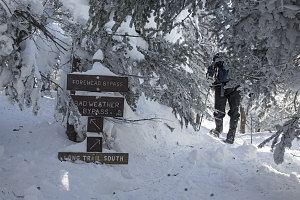
One of the few uncovered signs
What turned out to be a promising path through the trees petered out, and after Guillaume's smaller-sized snowshoes caused him to fall into several spruce traps, we gave up on The Forehead. We knew we were close and that a period of determined bushwhacking would see us through, we decided to re-focus on the main objective - a traverse northward to visit The Nose and The Chin - the two highest points along the ridgeline.
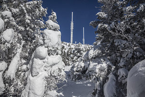
The Nose is close
Once back on the tracked path, we continued north. Very soon we arrived at what looked like a groomed ski run. Well, it was effectively a groomed ski run, but its real purpose was to serve as an access route to a cluster of communication towers and buildings near the sub-summit of The Nose. That meant our first highpoint objective was soon upon us.
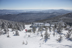
Nearing The Nose
Crossing the access road, we began a climb up towards the top of the Nose, past buildings, radomes, trusses and towers of the communication complex. The wind, which had been fairly quiescient during our walk through the thick scrub, now made its presence felt and then rapidly ramped up as we climbed up into open terrain. By the time I had walked past the towers and onto the highest, completely open point of The Nose, a strong northwest wind - by my estimation roughly at near-gale force (50-60km/hr, 30-40mph) - blew straight towards me.
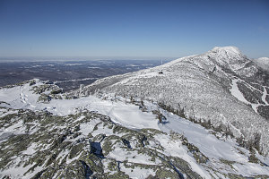
Fabulous Nose View
The view from The Nose was surprisingly excellent. The terrain to the north fell away in steep cliffs, providing a grand panorama in that direction. The main ridgeline and the highpoint of the Chin most prevalent, and the smaller but still-open knob of the Adam's Apple beyond and to the right. In all other directions the land fell away sharply to either flat lowlands or lower peaks - the terrain on Mansfield clearly shouldered above all nearby terrain. And the sky: completely clear and blue.
The Chin and Adam's Apple
Ewart Approaches Nose Summit
Despite the fabulous view, the combination of about -25C temperatures and a 60km/hr wind made for a very substantial wind chill value, and this did not encourage idle loitering. Even though I had wisely elected to put on my goggles and facemask, it was clear that I needed more layers to compete with these conditions. Therefore, after taking a few quick pictures, I left Ewart and Guillaume to their own quick visit to the summit of The Nose, and I descended back down to below the comm towers, which was in the lee of the wind and directly facing the sun - i.e. much more amenable to waiting!
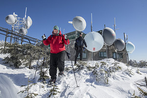
Descending from the Nose
Soon, Ewart and Guillaume also returned back down. Ewart promptly stated that he was abandoning the rest of the circuit, and returning back down the way we'd come up. He didn't have a facemask or goggles, for one, so his decision did have a certain logic. With wind chill values potentially so low, and with an extended period of above treeline terrain coming up, it was probably the wise thing to do. Ewart, bring the full complement of deep winter gear next time!
So, we agreed that Guillaume and I would continue along, and Ewart would return back south, along our ascent route. If Ewart's ski gear was still at the loop start point when Guillaume and I arrived at that same point, we would know something had happened to Ewart and that we'd go looking for him. If not, it meant that Ewart would be waiting for us down at the car. Hopefully for not too long.
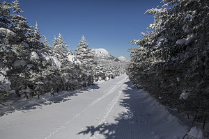
Comms Access Road
Now down to a party of two, Guillaume and I continued. When Ewart ducked back into the trees to follow the Long Trail south, we continued north, along the comm facility access road. This was much easier than finding the continuation of the Long Trail north through the trees, for which there appeared to be no sign (read - likely buried). Still, at this point, the objective was obvious: rising above us to the north was the open terrain of the north end of the ridge, topped by the summit of The Chin. We just needed to keep heading towards it.
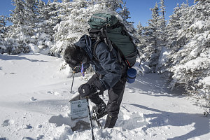
Digging for Information
Keeping our eyes peeled for trail indications, we soon spotted the tip of a pointed bit of wood off to our left. Guillaume did a bit of exploratory digging and found that it was indeed the tip of the sign assemblage for the Long Trail. Although no snowshoe tracks could be seen, a laneway through the dense conifers led north beyond.
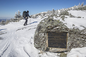
Mansfield Natural Area
The untracked trail led through the increasingly thinning scrub. Soon we'd be entirely in the open, possibly exposed to the same sort of winds we encountered at the top of The Nose. Wanted to be as fully prepared as possible before that point, we took a small detour to the lee side of a small crag to the right of the trail. Temporarily out of the path of any wind, we stopped and had a small snack break. I took out pretty much all of the remaining outerwear I had in my pack and layered it all on, including my larger outer parka and wind pants.
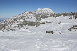
Nearing the Chin
Now better-clothed, we continued on. Whilst stopped, I had placed my goggles under my balaclava and hood, and directly against my head. This turned out to be a bad idea, for the warm and humid environment created moist air in and around the goggles that quickly froze when I re-placed the goggles onto my face. Within minutes a layer of uneven frozen condensation coated the inside and outside of the visor. Although I could still see light, I could see virtually no detail, and moving forward was greatly slowed as a result of having to stumble ahead over the terrain. I took to briefly lifting the goggles away so I could steal a clear glance at the terrain, memorize it, and then attempt to move forward a few yards. Repeat every twenty seconds or so.
This wasn't a very great solution, and I soon fell behind Guillaume, who apparently was not suffering the vision impairment issues I was having. The wind, although not as strong as on the top of The Nose, was still more than strong enough to quickly induce frostbite, so not having anything on the upper part of my face was not an option. Eventually, I veered off the path of the trail and to the east, angling to find a calm spot in the lee of The Chin.
What useless goggles are like
Soon I found a spot where the wind was nearly calm, and I waved Guillaume over. I took some time in the calm air to try and scrape away the ice on my goggles' visor, but it soon became clear that not only were the inner and outer surfaces covered with frozen condensation, but an inner space between the inner and outer surfaces was also iced up - and there was no way to get that clear without drying out the goggles in a warm environment. So, basically the goggle were useless. I instead decided to carefully fashion a narrow horizontal slit, bounded on the lower end by my nosemask, pulled as high up as possible, and on top and on the sides by my Parka's hood, pulled as far forward as possible to create a long, deep tunnel.
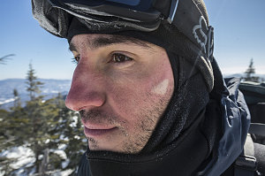
A bite of Winter
Guillaume and I had been doing periodic frostbite-checks since we had emerged above treeline. Any time we saw something on each other that looked exposed and which seemed suspect, we would flag it so that it could immediately be re-warmed and covered. Guillaume turned out to have most of the trouble here - often getting little white triangles of frostnip on his upper cheekbones, just below the line of the goggles. It seemed that his goggles, although great visibility-wise, were a bit too small for his face.
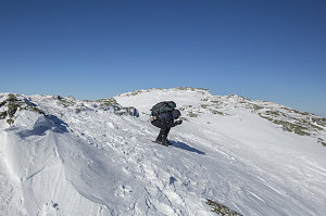
Very grippy skis
Now very close to the actual highpoint on Mansfield, we continued on. As it turned out, my tunnel-slit solution alternative to my goggles worked fairly well: It blocked nearly all of the wind and I had a clear - albeit narrow - slit through which to view the world. Soon we were on the summit of The Chin - the highpoint of the entire ridge, and therefore, the highest point in all of Vermont. As might be expected, there were perfectly-clear views in all directions. Curiously, the wind here did not feel as strong as it had on The Nose. Perhaps the overall wind speed was dropping as time passed.
Despite the slightly-lowered winds, we didn't dally long. Guillaume's periodic frostnip patches and the desire to not keep Ewart waiting too long had us moving down off of the summit in short order. We headed briefly back south, to the junction with the Sunset Ridge Trail. The Sunset Ridge Trail is a long, exposed ridge that extends down and to the west, and would be exposed to the full force of north-western winds. We were prepared for this possibility and kept all bits of skin fully covered in anticipation.