My work colleague Guillaume - an avid outdoorsman - likes to go on challenging winter camping outings. He'd been planning an outing for 2015, and had settled on doing a trip on Mount Mansfield, the highest mountain in Vermont. Unfortunately, his camping companions had to drop out, and Guillaume's trip had to be cancelled. His discussions with me about the logistics of a camping outing on Mansfield got me thinking - thinking about how nice a hike on Mt Mansfield can be, with its beautiful extensive open ridgelines. Since I hadn't been up Mansfield for many years, perhaps now was a good time to return!
The previous two times I'd climbed Mansfield, I'd gone over (or up to) the highpoint and then back down. I wanted to explore something new with this visit, so I charted a route that was based on an idea Guillaume had floated: a traverse of Mansfield's long north-south multi-bumped summit ridge. This would be accomplished by utilizing two west-side trails: the Maple Ridge Trail at the south end, and the Sunset Ridge trail at the north end. Starting at Underhill State park (again on the west side of the mountain), this worked out to a roughly 16km (10mile) semi-loop route.

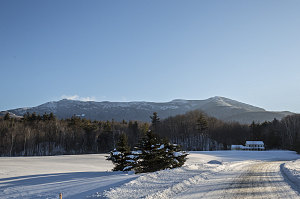
Morning Mansfield View
As is usual for me-led trips, we waited for a clear-weather forecast. This turned out to be Monday, Feb 16. It was going to be a cold one, though - with forecast temperatures ranging from a low of -28C (-18F) to a high of -15C (5F) - in the valley bottom. We could count on a 5-6C (9-11F) reduction in those temperatures while hiking along the summit ridge. Reasonably frigid!
Along for the fun today were two others, one new, and one not: Occasional but dependable hiker Ewart, and new-for-us hiker Guillaume (this would have been part of his camping outing weekend, but seeing as how none of his friends could make it, he became available for a day-hike). Welcome, Guillaume!

The Winter Start
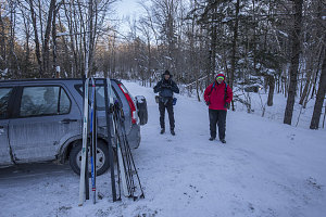
As mentioned above, the start point for our semi-loop hike along Mansfield's summit ridge was Underhill State Park, nestled under the western flanks of Mt Mansfield. In winter the road into the park is plowed to a point about a 1.3km (0.8 miles) before the park gate. From here you need to proceed under your own power up through the park, to the summer trailheads. We'd understood that snow conditions were quite good at this point, so we elected to bring cross country skis to ski up/down this road section, hoping to achieve some time efficiency and boredom-reduction on the way in and out.
The uphill skiing turned out to be great for myself - I had selected the right wax and had no problem gripping up the slope leading through the park. Guillaume, on the other hand, seemed to have virtually no traction with his skis. In fact, before finishing with the skiing section, he took off his skis and walked the remaining distance.
Even though it was below -20C (-4F), we were well-clothed, moving vigorously, and there was very little wind. In fact, we all felt quite warm, and the clean fresh snow and clear morning sun made for a very beautiful winter scene in Underhill State Park. By the time we arrived at the principle summer trailhead, hats were off and jackets were unzipped, and moist breath had condensed into lots of head frost.
The summer trailheads marked the point where we abandoned our skis in favor of snowshoes. This was the start of the loop portion of our hike. From here, we would head south, along a trail called the CCC Road (presumably built by the Civilian Conservation Corps back in the '30s). This old road would bring us more or less along the level across Mansfield's western flanks until we reached the Maple Ridge Trail, where we would then begin our ascent up to the summit ridge.
After switching to snowshoes and stashing our skis, we set out along the CCC Road. Guillaume had worried that this section of trail might prove to be unused and therefore unbroken, but this was not the case - a narrow but clear snowshoe/ski track led up a wide open corridor through the forest.
The CCC Road sloped upwards at a very slight grade, and along with the pre-existing track, the going was easy. Owing to the road's wide path, there were no slowdowns due to obstructions.
The road reached a highpoint at about 2750 feet, then began to descend again. By the time we reached the junction with the Maple Ridge Trail, we had descended back down to almost the same altitude as when we had started (along the CCC Road). Towards the end, we noticed swooping tracks coming down from the forest above the trail. Soon it was clear that these were backcountry ski tracks, deftly describing tracks and arcs that avoided the not-insubstantial number of trees. A bunch of skilled backcountry skiers had been through here!

Much steeper now
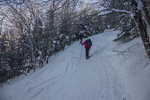
Unlike the traversing CCC Road, the trail heads straight uphill, directly towards Mansfield's summit ridge. The grade was immediately steep and remained so. This in itself was not unusual, in my experience of "eastern" mountain trails. What was unusual was the width of the trail - it was road-width wide. Furthermore, it had clearly been used more as a backcountry skiing route than a hiking trail. Evidence of snowboards and skis textured the snow of the trail, and a full twenty-foot wide width had been packed into a surface not unlike what you would find at a downhill ski resort. It was, in effect, a backcountry ski run. Fortunately for us, no one seemed to be zooming down the trail at the moment, but it would certainly be wise to pay attention. On the plus side, the firm, packed surface was perfect for snowshoeing uphill.
(update: sometime after the hike, I discovered (through an online posting) that we had in fact veered off of the Maple Ridge Trail and onto what is called the Teardrop Trail - an old backcountry ski route. We were still roughly parallelling the Maple Ridge trail, though).
Despite the steep grade, the perfect trail conditions allowed us to gain altitude fairly rapidly, gaining 1000 feet in under an hour. Soon we had glimpses of the snowy, open ridges and summits above, and back behind us, views through the trees to the western lowlands below.
We eventually reached the zone of predominantly coniferous trees, and with the fresh, heavy snows and lack of a recent thaw, everything around us was christmas-tree perfect.
Given the forecasted temperatures and potential for wind on the open terrain above, I elected to pre-emptively stop while in the trees and put on several more layers, including my nose mask and goggles.