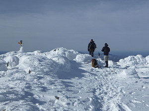
We struck up a chat with a fellow hiker - who we learned was named Ben - on the summit. He was the only other person we had seen on the trail today, and we had been moving at very similar speeds, playing a hopscotch-like back-and-forth game as we had been climbing towards the summit.

courtesy JInnes
Jenn sheltering from wind
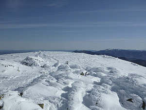
After taking a final congratulatory picture of Jenn on this, her 110th of the NE 111er summits, we started back down. Only five more summits to go! (The NE 111er list actually has 115 mountains on it).

courtesy JInnes
Making our way back to treeline
The descent back east towards Kinsman Notch started off quite scenically, but otherwise uneventfully. We were soon back into the trees, where we made rapid progress back towards Mt Blue. Being back in the trees and out of the wind, and with a strong sun beating down on us, we were soon quite hot again - necessitating a de-layering break. The change of weather predicted for mid-day was starting to arrive, although at this point only in the form of a high, thin haze that did not fully block out the sun.
Back to the frosted trees
Turning a bit more springlike
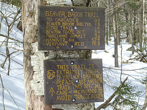
Warning at top of Beaver Brook Tr
Onwards we went, rounding Mt Blue and across the flats to the top end of the Beaver Brook trail, where a sobering trail signs warns of the extreme nature of the trail ahead. We were actually looking forward to this part of the descent; we had seen the excellent trail conditions on ascent, and knew that these conditions in combination with the very steep grade meant that things were perfect for an extended amount of butt-sliding - a very efficient, rapid, and fun way to descend an otherwise knee-jarring section of trail.

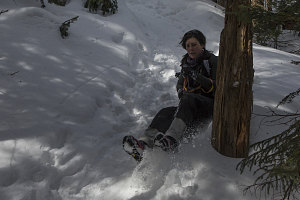
Beaver Brook Butt Sliding
Fun it was, indeed. The deep snow and the nicely-sculpted track meant there were no nasty bumps or other obstacles to worry about, and we cruised down most of the length of the Beaver Brook trail, taking full opportunity to keester-slide where appropriate. We dropped 2000 feet in less than 30 minutes.

courtesy JInnes
Warning at bottom of Beaver Brook Tr
As mentioned at the beginning of this report, the bottom of the steep part of the Beaver Brook trail is pretty much at the level of Kinsman Notch, so it was only a few more minutes - perhaps ten at most - before we arrived back at the parking lot.
Our outing had gone off with precision timing - in early; good pace; no hiccups; great views - and we were back before the clock struck 11. Enough time to make it back to Ottawa for Easter dinner!
Interactive trackmap with photo points - Moosilauke via Beaver Brook Trail - click map to view
Mount Moosilauke via Beaver Brk Trail - Hike Data
Start Time:
5:34a.m.
End Time:
10:55a.m.
Duration:
5h20m
Distance:
10.91 km
(6.78 mi)
Average Speed:
2.0 km/hr
(1.3 mph)
Start Elevation:
1811ft
(552m)
*
Max Elevation:
4760ft
(1451m)
*
Min Elevation:
1776ft
(541m)
*
End Elevation:
1793ft
(547m)
*
* : +/- 75 feet
Total Elevation Gain:
3087ft
(941m)
*
Total Elevation Loss:
3105ft
(946m)
*
* : +/- 75 feet
Elevation Graph