courtesy JInnes
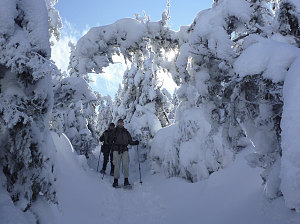
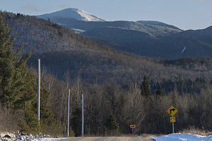
Algonquin through the trees
At Indian Falls we caught up to the injured hiker -- Rob -- that we had met earlier in the day. He seemed to be doing well enough, and after a brief chat, we continued on, arriving back at Marcy Dam an hour later. It was practically balmy at the dam, and as we switched back to our skiis, we were slightly worried that any reduction in the snow on the South Meadows fire road might render it completely unskiiable.
Afternoon at Indian Falls
After stopping for an unexpected chat with Robbie Morrison -- a fellow hiker friend from Ottawa with whom I've done several hikes -- we started our ski down the fire road. To our surprise, there had been a ton of ski activity since we laid down our fresh tracks early that morning. And, rather than the conditions being worse than in the morning, they were actually much better. Somehow the ski traffic had created a thin hard pack that was somehow better at concealing the underlying ground than the fresh snow had been.
The first two-thirds of the way back were pretty decent for skiing, although one still needed to keep an eye out for the occasional boulder or branch sticking out above the snow. The final, lower third was not so great, and in a few places we actually had to step with our skis or take them off entirely. Overally, though, the improved conditions -- along with the fact that we were headed slightly downhill most of the way -- resulted in us getting to the South Meadows trail register in under an hour.

Final look at Marcy
After signing out, it was a straightforward ski back along the South Meadows road for about a mile or so back to Adirondak Loj road and our waiting car, just after 4pm. An average speed of over 3km/hr (1.8 mph) ranked this climb as the fastest overall "long" hike I've ever done in the Adirondacks. To date, anyway.
Interactive Trackmap, Marcy Winter Climb - double click to view
Hike Data - Climb of Mt Marcy via South Meadows
Start Time:
7:23a.m.
End Time:
4:03p.m.
Duration:
8h40m
Distance:
27.25 km
(16.93 mi)
Average Speed:
3.1 km/hr
(2.0 mph)
Start Elevation:
2101ft
(640m)
*
Max Elevation:
5458ft
(1664m)
*
Min Elevation:
2032ft
(619m)
*
End Elevation:
2068ft
(630m)
*
* : +/- 75 feet
Total Elevation Gain:
3558ft
(1084m)
*
Total Elevation Loss:
3577ft
(1090m)
*
* : +/- 75 feet
Elevation Graph
