This trip report is, like many others on my webpage, a fairly standard accounting of a beautiful day climbing two of Maine's higher peaks, both in Baxter State Park. The lower of the two is Fort Mountain -- a 3,800+ foot peak with an open summit and a very interesting plane crash [not far from the summit]. The other higher mountain is North Brother, at just over 4,000 feet. It is this second mountain that makes this trip report a little more special than the others, for my ascent of it marks the completion of the so-called Northeast 111 list.
For those of you who do not know of it, the Northeast 111 is a combined peak-bagging list that encompasses all of the peaks in the Northeastern U.S. that have a summit elevation of greater than 4,000 feet. It is comprised of the Adirondack forty-six, two 4,000-footers in the Catskill Mountains; the five 4,000 footers in Vermont; the New Hampshire forty-eight; and finally, the fourteen peaks in Maine that rise above the magic 4k mark. If you are an astute, mathematically-oriented reader, you'll find that those numbers add up to one hundred and fifteen. Not one hundred and eleven. Since the inception of the 111 list, four additional peaks were surveyed and added to the list. Why the lack of a name change? I suspect that being a 111er looks and sounds cooler than being a 115er.
courtesy JInnes
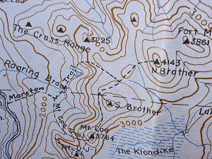
Topo of the route
In any case, by October of 2011 I had indeed climbed 114 4000-footer peaks in the Northeastern U.S., and only one peak remained. And, as you may know from the completion of my other mountain lists, I like to aim for a scenic summit and nice weather upon the day on which I finish. North Brother, although relatively low at 4,150 feet, has a very nice alpine summit with 360 degree views. Criteria one, check. And the weekend of October 8-9 satisfied the other criteria, that being a clear and stable forecast. Criteria two, check.
Baxter State Park is a fairly long drive from my home town of Ottawa, necessitating a drive down the day before the planned hike. Because we were approaching from the northwest, we were loathe to drive the long way around to the south and back up through Millinocket to the park gates. We chose instead to approach via un-paved access roads from the west; namely, the Greenville road leading northeast from the town of Greenville, Maine, and the Golden Road -- an arterial resource access road that cuts through Maine from Millinocket to the Canadian Border. If you are interested in this way of accessing Baxter State Park, please go to the last page in this report, where I describe the way in greater detail.
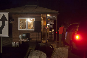
Baxter State Park Gatehouse
We stopped for the night and did some at-large camping along the Golden Road just a few miles from the Baxter State Park entrance. We wanted to get an early start, and we knew that Baxter's closed-gate policy, potential for long lineups, very slow park roads, and individual parking lot quotas meant that we should probably be up before dawn and at the gates before opening to maximize our chances of getting in and getting a spot at our trailhead.
There is basically one main way to access North Brother, and that way is via the Marston Trail. There is an optional side route that goes over a few additional peaks along the way, but we did not intend to use that route. The trailhead for the Marston Trail is at Slide Dam, about 21km (12.5 miles) up the slow dusty park road from Baxter State Park's southern gatehouse.
We arrived at the [happily-]empty Slide Dam parking lot at about 6:30am, with a clear and pastel-colored pre-dawn sky above us. The parking lot and trailhead is right at the bottom of a fairly narrow valley between Doubletop Mountain and the Brothers. The watercourse in the bottom of the valley -- the Nesowadnehunk stream -- flows by just on the other side of the park road from the parking lot.
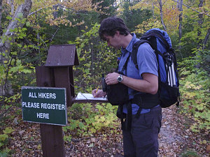
We started off on the trail before seven, and were soon making good time up the trail. The initial part of the Marston Trail meanders on the flat through pretty and open hardwood forest -- still mostly green even though we were well into October. After a few minutes of this, the trail gently bends to the right, becomes a bit more rough, and starts a steady but only moderately-steep ascent to the east, up the lower flanks of the Brothers.
courtesy JInnes
Junction with Mt Coe Trail
At about the 2000-foot mark, the trail became nearly flat, and soon after, we arrived at the first of two trail junctions on our trip. This was the lower junction with the Mount Coe trail -- a side route that leads up and over the top of Mt Coe, then on over the summit of South Brother, and then finally rejoining with the Marston Trail in the saddle between South and North Brother. As I said earlier, we did not elect to take this alternate, longer route. We wanted to save any extra time we had for a visit to Fort Mountain and the interesting-sounding plane crash on its upper slopes.
We turned left at the lower junction and continued on up the Marston Trail. It was still very easy going, and the grade was very slight. There was a fairly thick carpeting of leaves that made it a bit hard to see any loose stones underfoot, but that was about it. The weather was good, conditions were very dry, and the trail had little erosion. In very short order we arrived at the next notable spot along the route -- an un-named pond in a wooded bowl beneath steep slopes and slabs, at about 2,400 feet. The shores of the pond were a bit clogged with driftwood and brush, so we didn't linger for any longer than it took for a quick photo snap.
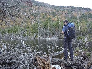
courtesy JInnes
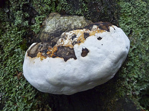
courtesy JInnes
The Marston trail skirted around the pond (and this was pretty much the only spot along the trail where there was any sort of wetness or mud), then started a fairly (but not overly) steep and root-filled ascent up the slopes just to the north of the wooded bowl. This was, in retrospect, probably the steepest part of the entire route to the top.
As the trail neared a point directly north of the aforementioned slabs, we got the first of several nice viewpoints to the south. These viewpoints give a nice targeted view towards Doubletop, which, in the early morning sun, looked big and impressive - even though its summit altitude does not exceed 3,500 feet.
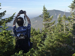
courtesy JInnes
Valley of the Nesowadnehunk
The trail had now reached the beginnings of the broad, gentle saddle that exists between South and North Brother. The grade of the trail lessened, and it became one of the most perfect forest trails you could imagine: flat, smooth, covered with a soft cushion of needles, hardly any stones or boulders, and lined on either side with a pretty carpet of moss.
After about twenty or so minutes of this type of idyllic hiking, we came to the upper junction with the Mount Coe trail.
Upper Junction w/Mt Coe Trail
Upper Junction w/Mt Coe Trail
First view of North Brother Summit
We took a short break at the junction, noting that we were making pretty good time: it was only 8:45am, and we were only perhaps 2/3rds of a mile from the summit of North Brother. Finishing my NE111 was going to happen sooner than I had anticipated.