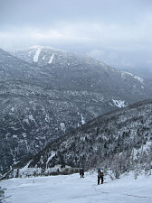
We began the long climb up the slab towards the summit. The condition of the surface was mixed. In places it was a tricky thin layer of ice over rock; in others, it was foot-deep snow; and yet in others, the snow had a hard styrofoam-like consistency, which was particularly good for cramponing.
We climbed with a running belay. The initial bit of climbing on the slab was a bit anxious, if for nothing more than we were suddenly in an exposed place. The route was difficult to protect in places, and Roland, still up ahead, placed a bit of improvised protection here and there: Small trees, a partially screwed in and girth-hitched ice screws - that sort of thing. As we climbed higher, though, we gained confidence in the situation and our cramponing, and it became less of an issue. Time was more on our mind now, as it was now nearing sundown.
We could now see the tell-tale perched boulder on the summit ridge above us, and we knew we were getting close. We stayed to the left, near the edge of the vegetation, and climbed steeply upwards as directly as we could. The weather conditions (although not clear, as we'd been promised in the forecast) were pretty decent - not cold and no wind.

courtesy RHanel
Finally, five hours after starting off from Avalanche Lake below, we crested the summit ridge of Mount Colden, almost precisely at sunset. We quickly packed away all of our climbing gear, got out our headlamps, and headed a few feet over to the "summits" of Mount Colden, where we took some light-painted night shots of Jenn, Roland and Caroline. I say "summits" because there are two spots which could both be reasonably considered to be the high point of Mount Colden, and I'm not sure which is. So - do both to be sure!
This was Jenn's winter 46r Mt Colden ascent. Done in style, too - via the Trap Dike!
After the summit shots, there was nothing more to do than trudge back. Fortunately, the trail conditions were excellent and the trail's grade back down was conducive to a quick descent. Down the trail to Lake Arnold, and on down to Avalanche Junction, back to Marcy Dam, and finally to the Loj parking lot. Three hours from summit to lot.
Interactive Trackmap & Photo Points - Trap Dike Climb - Click map to expand
Start Time:
9:05a.m.
End Time:
8:14p.m.
Duration:
11h9m
Distance:
18.04 km
(11.21 mi)
Average Speed:
1.6 km/hr
(1.0 mph)
Start Elevation:
2221ft
(677m)
*
Max Elevation:
4752ft
(1448m)
*
Min Elevation:
2092ft
(637m)
*
End Elevation:
2197ft
(670m)
*
* : +/- 75 feet
Total Elevation Gain:
2889ft
(881m)
*
Total Elevation Loss:
2909ft
(887m)
*
* : +/- 75 feet
Elevation Graph
