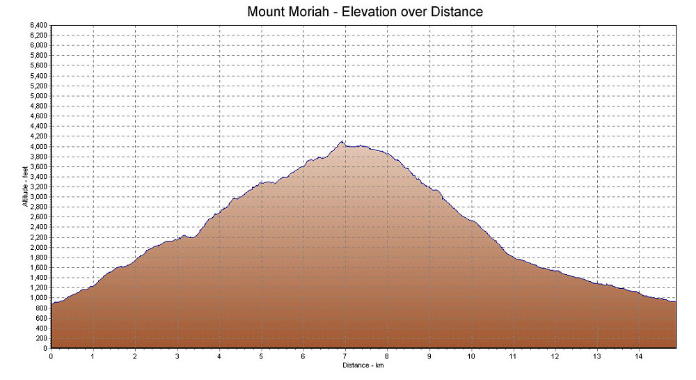
This is a GPS-derived elevation profile of the hike, graphed over distance.
This image is from the presentation "Mount Moriah".
 Go to presentation where this image occurs.
Go to location in presentation where this image occurs.
Go to presentation where this image occurs.
Go to location in presentation where this image occurs.
Copyright 2001-2016 alavigne.net.