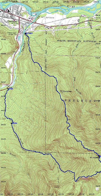
This is a topographic map of the area of the hike, with a GPS-derived tracklog overlain. Total distance was just under 15km.
This image is from the presentation "Mount Moriah".
 Go to presentation where this image occurs.
Go to location in presentation where this image occurs.
Go to presentation where this image occurs.
Go to location in presentation where this image occurs.
Copyright 2001-2016 alavigne.net.