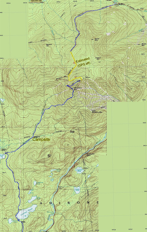
This is a GPS-derived tracklog of the hike, superimposed over a topographic map of the area.
This image is from the presentation "Whiteface Winter Backpack".
 Go to presentation where this image occurs.
Go to location in presentation where this image occurs.
Go to presentation where this image occurs.
Go to location in presentation where this image occurs.
Copyright 2001-2016 alavigne.net.