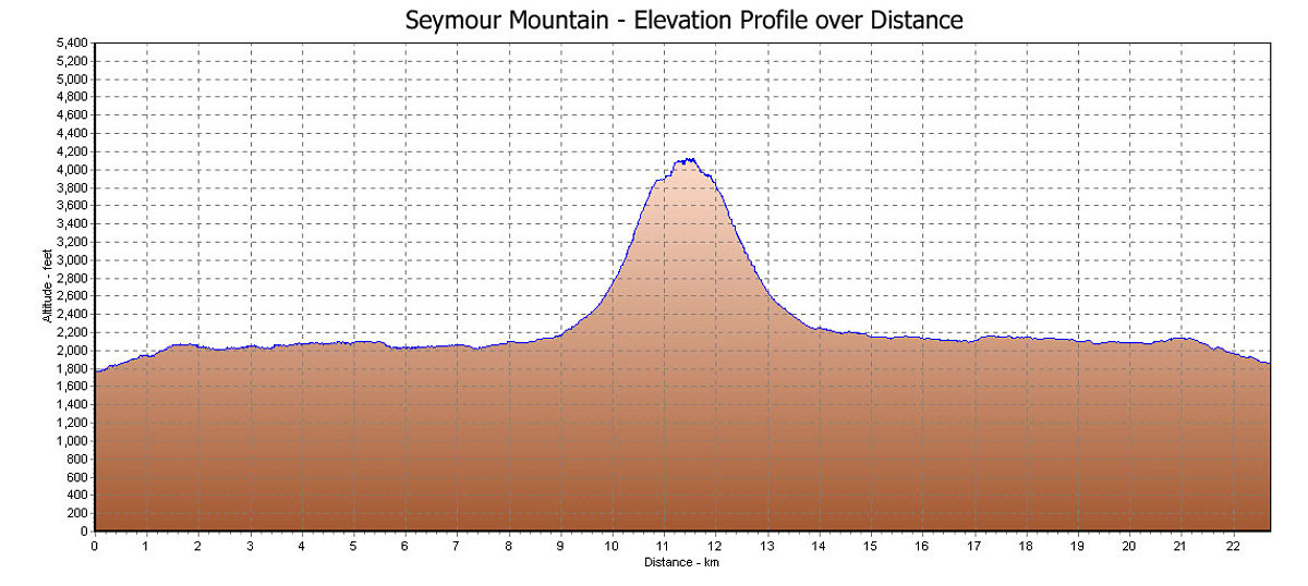
This is the GPS-derived profile of the elevation, graphed over distance. Of note is how the approach to this hike is very flat. All of the Elevation gain occurs when the herdpath to the top starts. As a result, the herdpath section is pretty steep.
This image is from the presentation "Seymour Mountain".
 Go to presentation where this image occurs.
Go to location in presentation where this image occurs.
Go to presentation where this image occurs.
Go to location in presentation where this image occurs.
Copyright 2001-2016 alavigne.net.