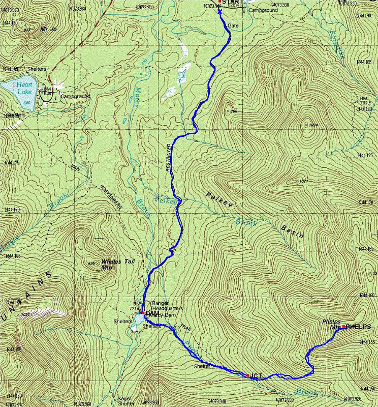
This is a USGS Topo map with my GPS tracklog overlaid upon it. Here's some salient facts about our hike:
Start time: 8:49 am
End time: 3:00 pm
Total Distance: 15.7 km
Average speed (including stops): 2.5 km/hr
Start Elevation: 2125 feet
Maximum Elevation: 4161 feet
This image is from the presentation "Phelps Mountain via South Meadows".
 Go to presentation where this image occurs.
Go to location in presentation where this image occurs.
Go to presentation where this image occurs.
Go to location in presentation where this image occurs.
Copyright 2001-2016 alavigne.net.