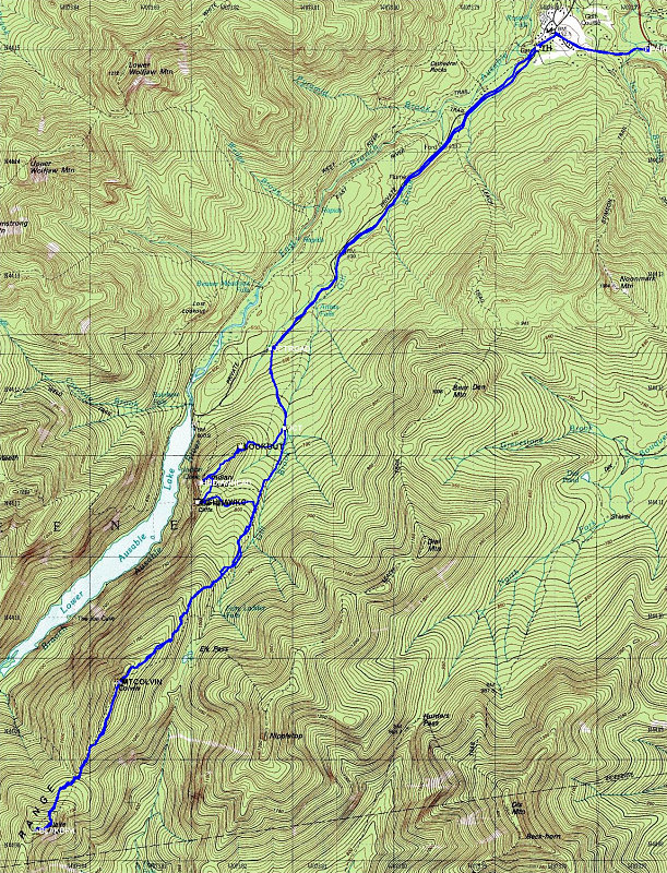
This is a topographic map of the area over which the hike traverses, overlain with a GPS-derived track of our actual hike.
This image is from the presentation "Colvin and Blake".
 Go to presentation where this image occurs.
Go to location in presentation where this image occurs.
Go to presentation where this image occurs.
Go to location in presentation where this image occurs.
Copyright 2001-2016 alavigne.net.