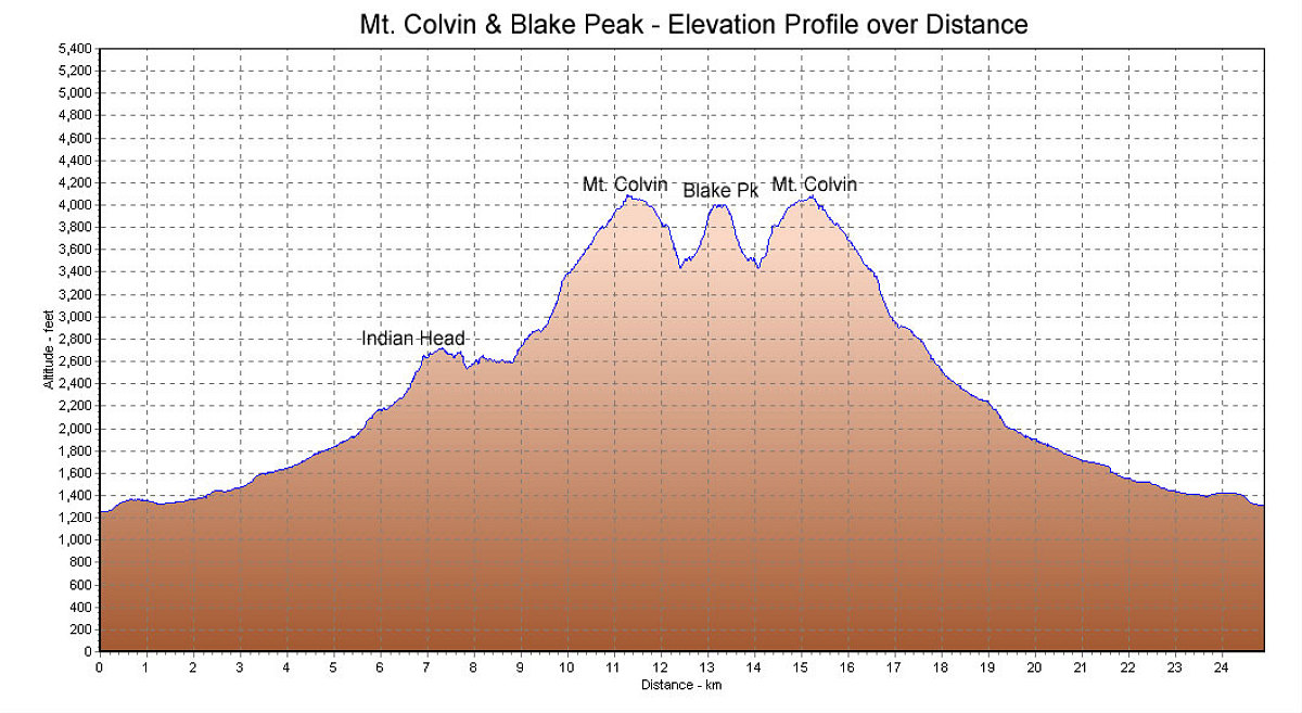
This is a GPS-derived elevation profile of the hike, graphed over distance. Total distance was approximately 24 km.
This image is from the presentation "Colvin and Blake".
 Go to presentation where this image occurs.
Go to location in presentation where this image occurs.
Go to presentation where this image occurs.
Go to location in presentation where this image occurs.
Copyright 2001-2016 alavigne.net.