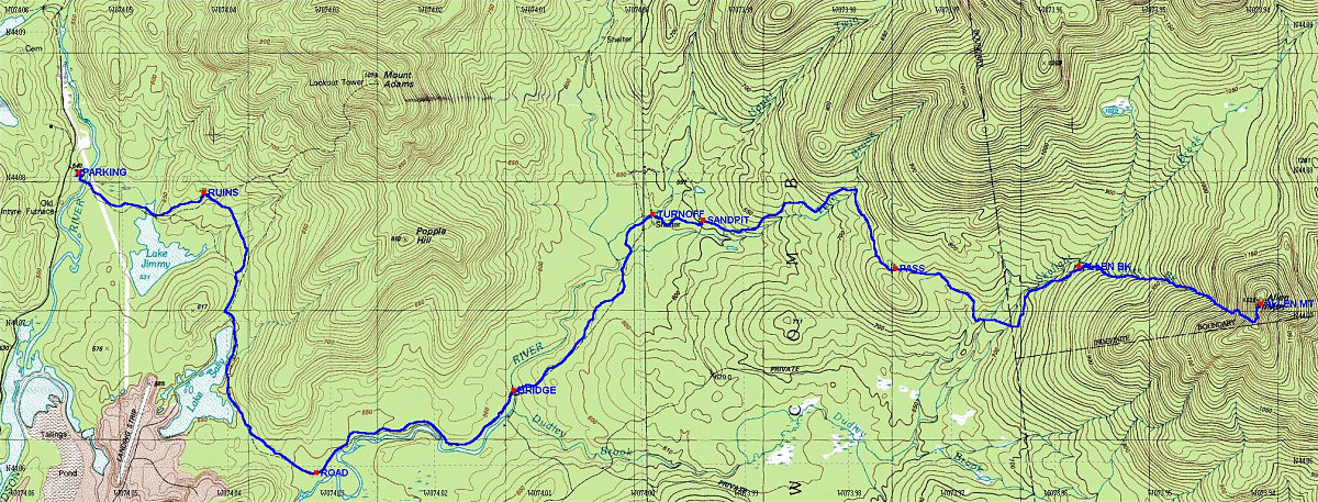
This is the GPS-derived track of the route overlain onto a topographic map of the area.
Total distance: 14.34 * 2 = 28.68 km.
Start Time : 7:34 am; End Time: 6:40 pm (11 hours 6 minutes)
Average speed (including stops): 2.6 km/hr
Total elevation gain: ~2950 feet (ascent, not counting return journey).
This image is from the presentation "Allen Mountain".
 Go to presentation where this image occurs.
Go to location in presentation where this image occurs.
Go to presentation where this image occurs.
Go to location in presentation where this image occurs.
Copyright 2001-2016 alavigne.net.