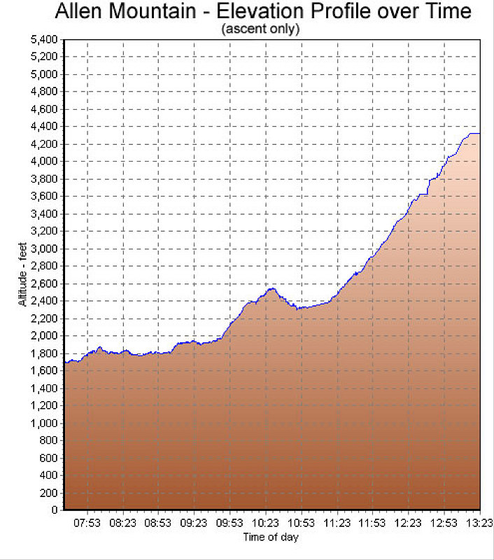
This is the GPS-derived elevation profile of the Allen mountain hike, over time. Note that this is only the ascent. We arrived back at the trailhead around 6:40pm. I was getting very poor GPS reception on the way down so I did not bother to make a profile of the return leg.
This image is from the presentation "Allen Mountain".
 Go to presentation where this image occurs.
Go to location in presentation where this image occurs.
Go to presentation where this image occurs.
Go to location in presentation where this image occurs.
Copyright 2001-2016 alavigne.net.