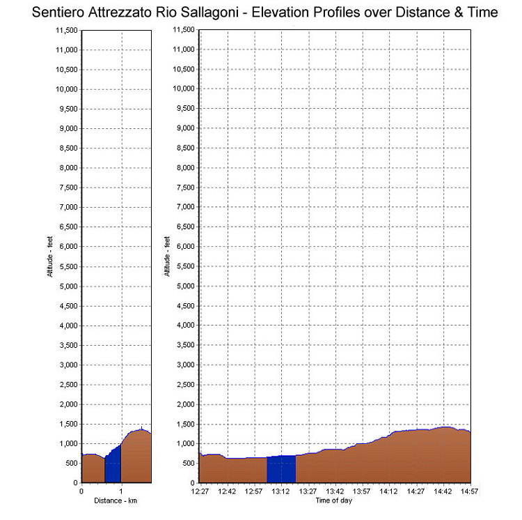
This is a GPS-derived elevation profile, over distance, of our climb of the Sentiero Attrezzato Rio Sallagoni. The blue section denotes the section that is the main via ferrata section (there are a few other very minor via ferrata sections). Note that this profile is of a one-way climb from start to finish, with no hike back down to the start point (we had a car at both ends when we climbed).
This image is from the presentation "Via Ferrata - Protected Climbing Paths in the Dolomites - Sentiero Attrezzato Rio Sallagoni".
 Go to presentation where this image occurs.
Go to location in presentation where this image occurs.
Go to presentation where this image occurs.
Go to location in presentation where this image occurs.
Copyright 2001-2016 alavigne.net.