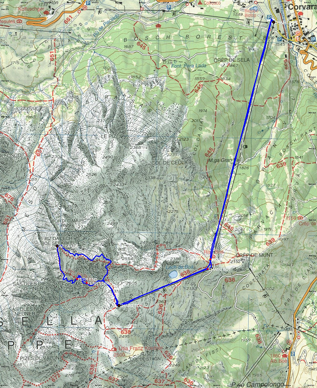
This is a Topographic Map of our climb up Piz da Lech in the Sella Group, with our GPS-derived actual route overlain in blue. The route can be reached by a two-stage cablecar from the town of Corvara (you can see the straight lines showing the cablecar portions).
This image is from the presentation "Italy 2005 - Maps and Graphs".
 Go to presentation where this image occurs.
Go to location in presentation where this image occurs.
Go to presentation where this image occurs.
Go to location in presentation where this image occurs.
Copyright 2001-2016 alavigne.net.