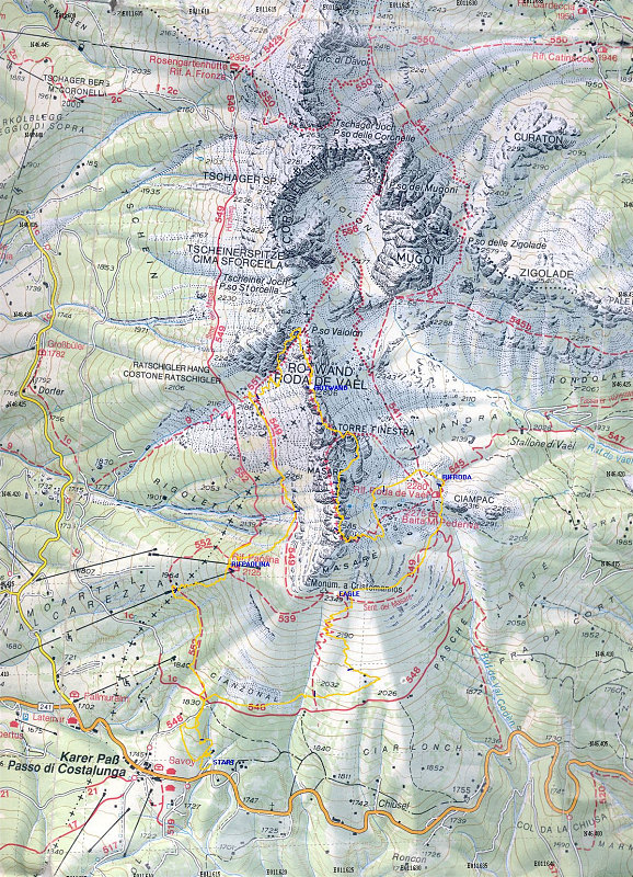
Topo map of the south rosengarten area with the path that we followed indicated by the yellow track. We stayed on trails most of the time. Note how inaccurate the trails drawn on the map are!
This image is from the presentation "The 2002 Europe Trip - Maps".
 Go to presentation where this image occurs.
Go to location in presentation where this image occurs.
Go to presentation where this image occurs.
Go to location in presentation where this image occurs.
Copyright 2001-2016 alavigne.net.