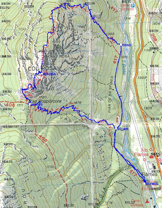
This Topographic Map shows our route on Col Rosa. The blue line is derived from an actual GPS tracklog of our path. We did this loop counterclockwise. It is also interesting to note how the trail drawn on the map is incorrect in places.
This image is from the presentation "Via Ferrata - Protected Climbing Paths in the Dolomites - Via Ferrata Ettore Bovero".
 Go to presentation where this image occurs.
Go to location in presentation where this image occurs.
Go to presentation where this image occurs.
Go to location in presentation where this image occurs.
Copyright 2001-2016 alavigne.net.