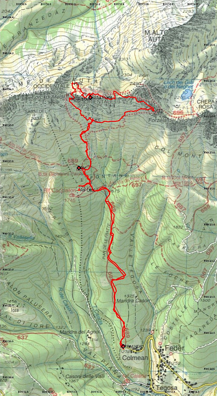
This is a GPS-dervied annotated topographic map of our Cima Auta climb up the Via ferrata paolin-piccolin. The red line denotes our actual ascent and descent, as captured by my GPS.
This image is from the presentation "Italy 2005 - The Dolomites".
 Go to presentation where this image occurs.
Go to location in presentation where this image occurs.
Go to presentation where this image occurs.
Go to location in presentation where this image occurs.
Copyright 2001-2016 alavigne.net.