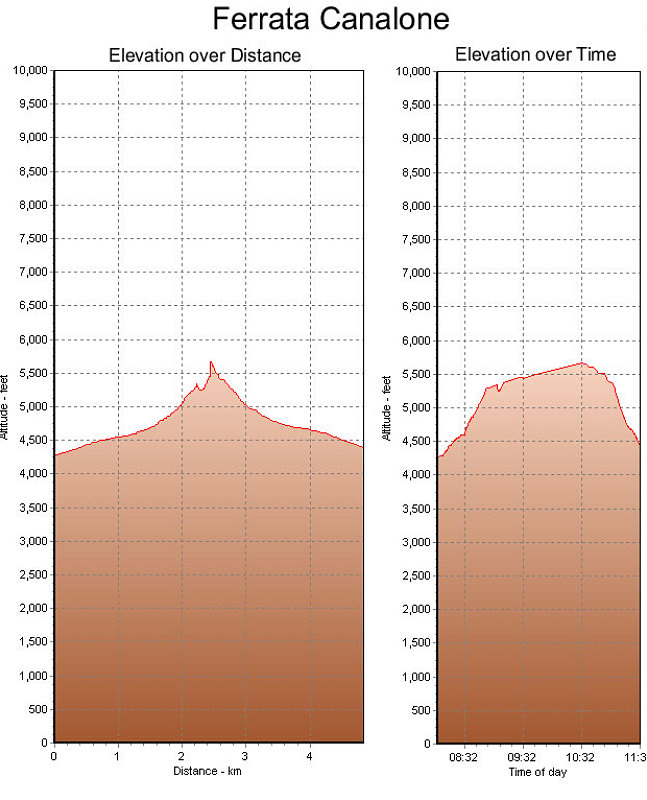
These are GPS-derived elevation profiles, over time and distance, of our climb up the Via Ferrata Canalone.
This image is from the presentation "Italy 2005 - Maps and Graphs".
 Go to presentation where this image occurs.
Go to location in presentation where this image occurs.
Go to presentation where this image occurs.
Go to location in presentation where this image occurs.
Copyright 2001-2016 alavigne.net.