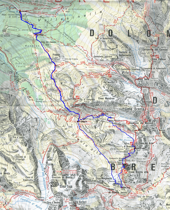
This is a topographic map of the area in which we hiked and climbed in the Brenta, including the central part of the Via delle Bocchette. Our route is marked by a GPS-derived tracklog, which is overlain on the map in blue.
This image is from the presentation "Italy 2005 - Maps and Graphs".
 Go to presentation where this image occurs.
Go to location in presentation where this image occurs.
Go to presentation where this image occurs.
Go to location in presentation where this image occurs.
Copyright 2001-2016 alavigne.net.