This is a GPS-Derived elevation plot of our hike, graphed over distance. There was a fair bit of elevation error during the middle of this hike. I've tried to repair it as best I can, but things may still be a little off in spots.
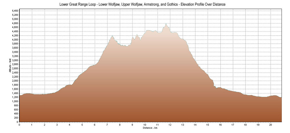
This image is from the presentation "A Liquidy Lower Great Range Loop".
 Go to presentation where this image occurs.
Go to location in presentation where this image occurs.
Go to presentation where this image occurs.
Go to location in presentation where this image occurs.
Copyright 2001-2016 alavigne.net.