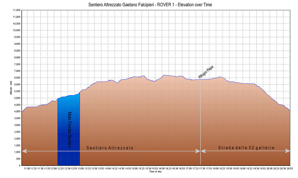
A GPS-derived elevation plot of our Hike of the Gaetano Falcipieri route and return via the Strada delle 52 Gallerie, graphed over time.
This image is from the presentation "The Dolomites and Via Ferrata 2007 - Gaetano Falcipieri and Gallerie 52".
 Go to presentation where this image occurs.
Go to location in presentation where this image occurs.
Go to presentation where this image occurs.
Go to location in presentation where this image occurs.
Copyright 2001-2016 alavigne.net.