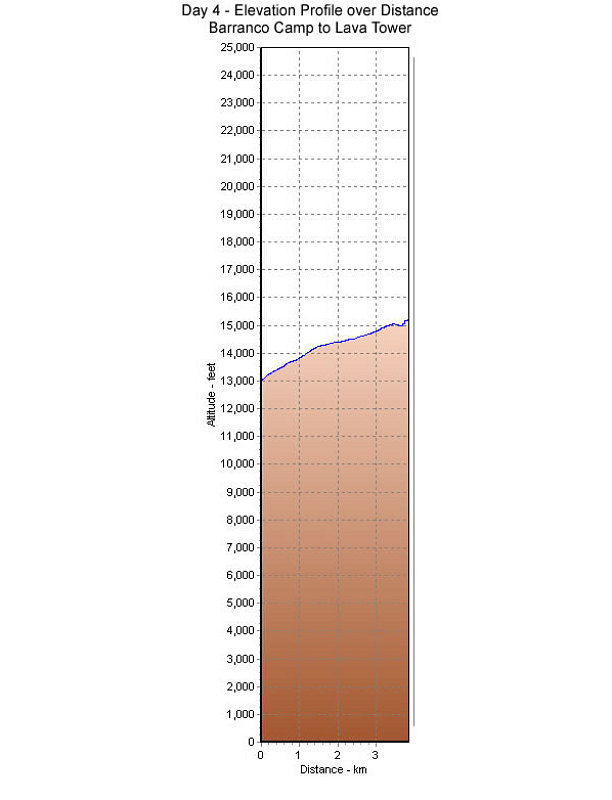
This is a GPS-Derived Elevation profile of our fourth day's ascent, graphed over distance.
This image is from the presentation "Kilimanjaro and East Africa - Maps and Graphs".
 Go to presentation where this image occurs.
Go to location in presentation where this image occurs.
Go to presentation where this image occurs.
Go to location in presentation where this image occurs.
Copyright 2001-2016 alavigne.net.