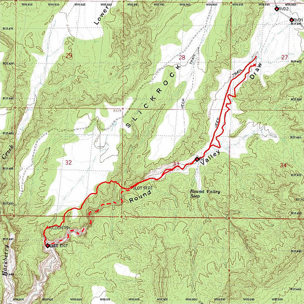
A Topographic map of the Round Valley Draw Slot hike with a GPS-derived track of our actual path overlain on top. Total distance hiked: approximately 12km. Note that the dashed section in the slot itself is not GPS-derived.
This image is from the presentation "Grand Canyon Backpack - New Hance Trail - Tonto Trail - South Kaibab Trail - Maps and Graphs".
 Go to presentation where this image occurs.
Go to location in presentation where this image occurs.
Go to presentation where this image occurs.
Go to location in presentation where this image occurs.
Copyright 2001-2016 alavigne.net.