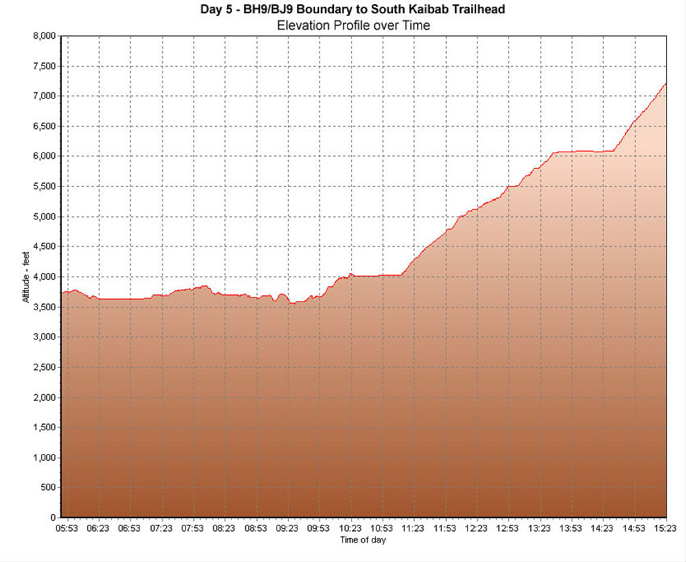
This is a GPS-derived elevation profile of our fourth day's hike from our campsites in Grapevine Canyon to our Tonto platform campsite along the BH9/BJ9 Backcountry boundary . This profile is graphed over time.
This image is from the presentation "Grand Canyon Backpack - New Hance Trail - Tonto Trail - South Kaibab Trail - Maps and Graphs".
 Go to presentation where this image occurs.
Go to location in presentation where this image occurs.
Go to presentation where this image occurs.
Go to location in presentation where this image occurs.
Copyright 2001-2016 alavigne.net.