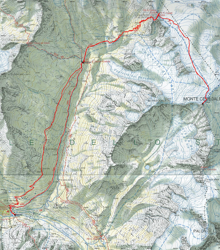
This is a topographic map of the area involved in our climb of Monte Cevedale in the Ortles Group. Our route is marked by a GPS-derived tracklog, which is overlain on the map in red.
This image is from the presentation "Italy 2005 - Maps and Graphs".
 Go to presentation where this image occurs.
Go to location in presentation where this image occurs.
Go to presentation where this image occurs.
Go to location in presentation where this image occurs.
Copyright 2001-2016 alavigne.net.