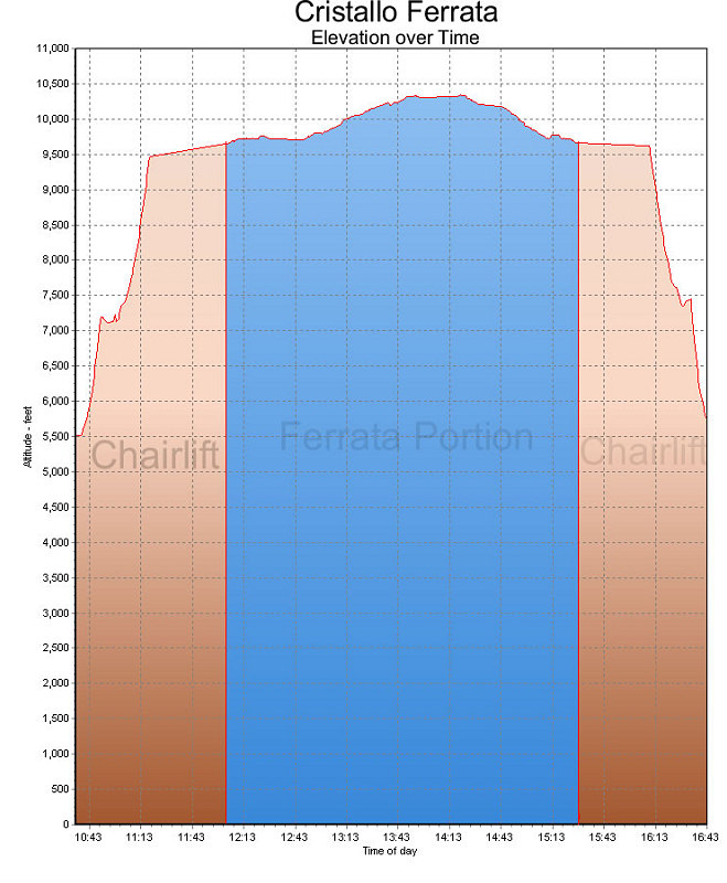
This is a GPS-derived elevation profile of our climb up the Middle Cristallo, over time. The ferrata portion is shown in blue.
This image is from the presentation "Italy 2005 - Maps and Graphs".
 Go to presentation where this image occurs.
Go to location in presentation where this image occurs.
Go to presentation where this image occurs.
Go to location in presentation where this image occurs.
Copyright 2001-2016 alavigne.net.