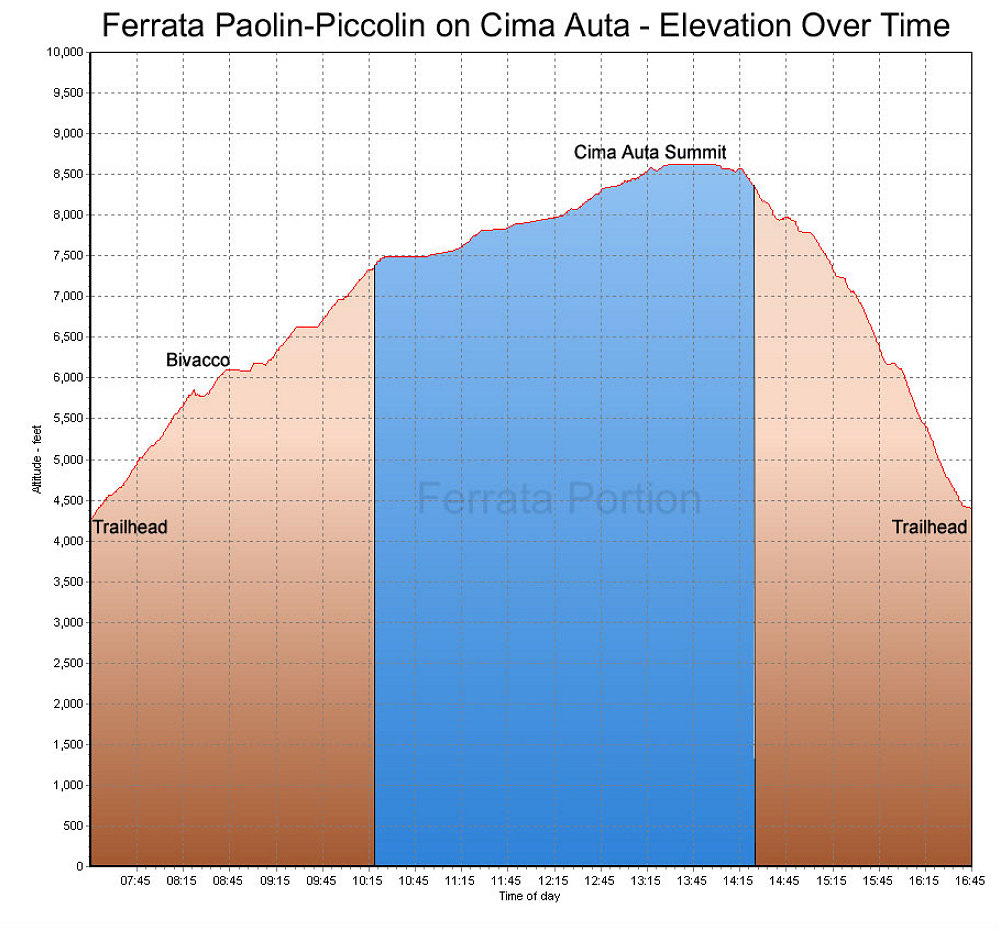
This is a GPS-derived elevation profile, over time, of our climb up Cima Auta (via the via ferrata Paolin-Piccolin on the way up). The blue section denotes the section that is the via ferrata climb.
This image is from the presentation "Italy 2005 - The Dolomites".
 Go to presentation where this image occurs.
Go to location in presentation where this image occurs.
Go to presentation where this image occurs.
Go to location in presentation where this image occurs.
Copyright 2001-2016 alavigne.net.