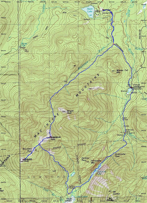
This is a Topographic map of our hike, overlain with a GPS-dervied tracklog.
This image is from the presentation "Algonquin and Iroquois Peak Loop".
 Back to presentation.
Back to presentation.
Copyright 2001-2016 alavigne.net.