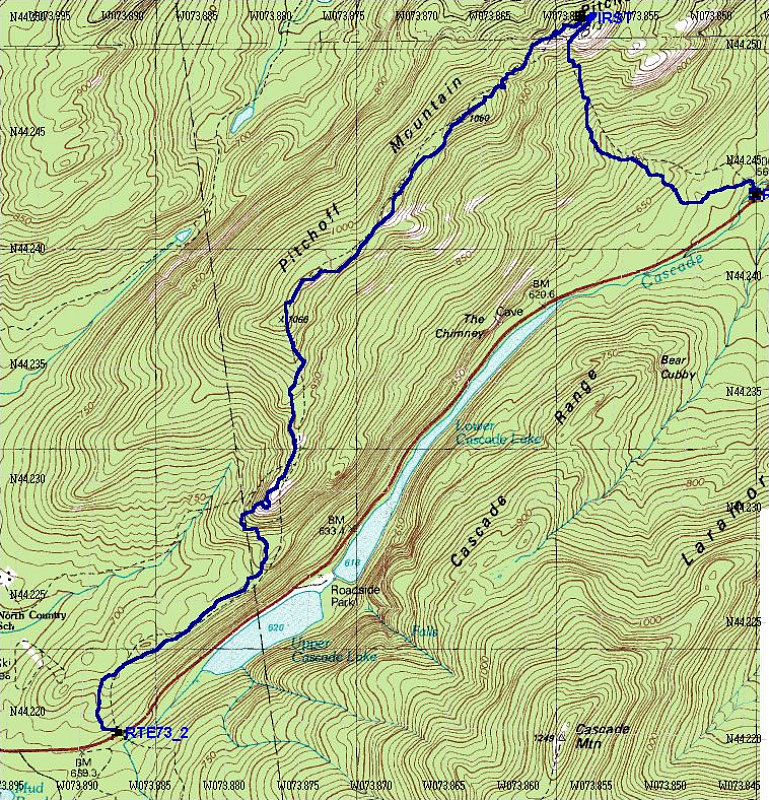
This is the topographic map of our hike, overlain with a GPS-derived tracklog of our exact route. Our way down from the last (westernmost) open area was a bit of a bushwack - we lost the trail for a bit. So consider that bit of tracklog as unofficial.
This image is from the presentation "Pitchoff Ridge Traverse".
 Back to presentation.
Back to presentation.
Copyright 2001-2016 alavigne.net.