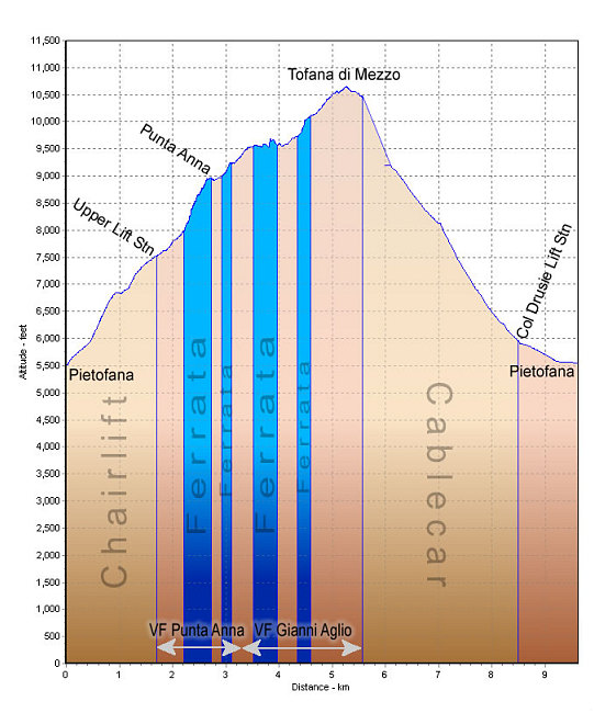
This is a GPS-derived elevation profile of the combination climb of VF Punta Anna and VF Gianni Aglio. The start and end point is the lower Pietofana chairlift station. The Blue sections are major ferrata portions of the routes. The gold sections denote distances covered using chairlift or cablecar.
This image is from the presentation "Via Ferrata - Protected Climbing Paths in the Dolomites - Via Ferrata Punta Anna / Via Ferrata Gianni Aglio".
 Back to presentation.
Back to presentation.
Copyright 2001-2016 alavigne.net.