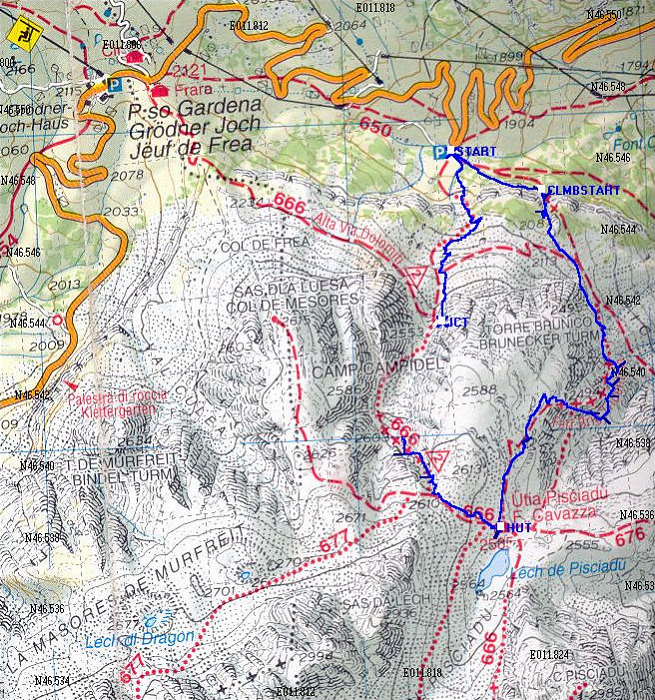
This Topographic Map shows the route up both of these ferrate. The blue line is derived from an actual GPS tracklog of our path. On the return path (Path #666) we lost the GPS signal for a little while in the gully, so there is no line for that part.
This image is from the presentation "Via Ferrata - Protected Climbing Paths in the Dolomites - Via Ferrata Brigata Tridentina".
 Back to presentation.
Back to presentation.
Copyright 2001-2016 alavigne.net.