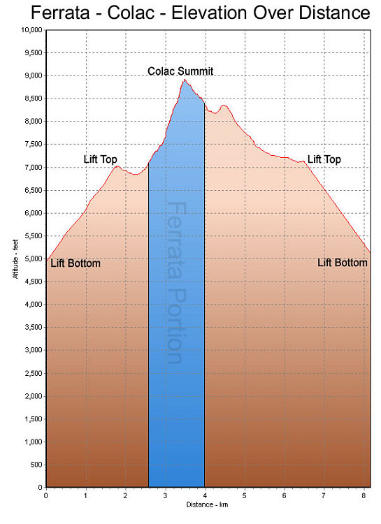
This is a GPS-derived elevation plot, over distance, of our climb up (and down) Colac. The climb up was via the via ferrata dei finanzieri. The ferrata portion of the climb is denoted by a blue region.
This image is from the presentation "Via Ferrata - Protected Climbing Paths in the Dolomites - Via Ferrata dei Finanzieri".
 Back to presentation.
Back to presentation.
Copyright 2001-2016 alavigne.net.