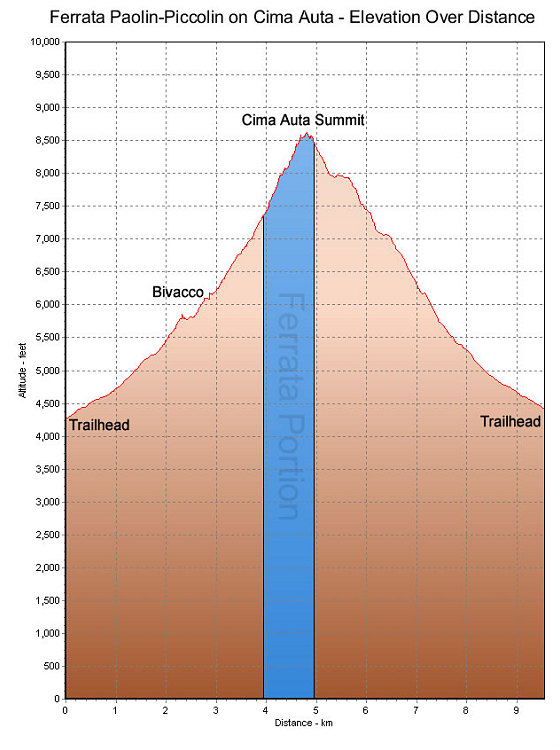
This is a GPS-derived elevation profile, over distance, of our climb up Cima Auta (via the via ferrata Paolin-Piccolin on the way up). The blue section denotes the section that is the via ferrata climb.
This image is from the presentation "Via Ferrata - Protected Climbing Paths in the Dolomites - Via Ferrata Paolin-Piccolin".
 Back to presentation.
Back to presentation.
Copyright 2001-2016 alavigne.net.