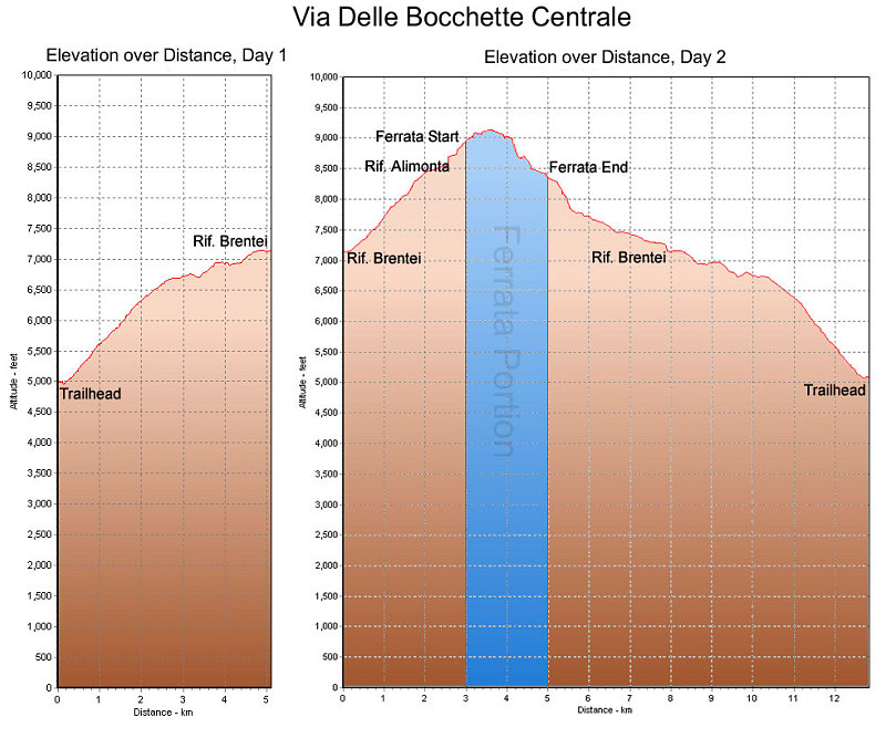
This is a GPS-derived elevation profile of our climb in the Brenta, graphed over distance. We climbed over a two-day period. The actual ferrata portion of the climb is marked in blue.
This image is from the presentation "Via Ferrata - Protected Climbing Paths in the Dolomites - Via Ferrata Bocchette Centrale".
 Back to presentation.
Back to presentation.
Copyright 2001-2016 alavigne.net.