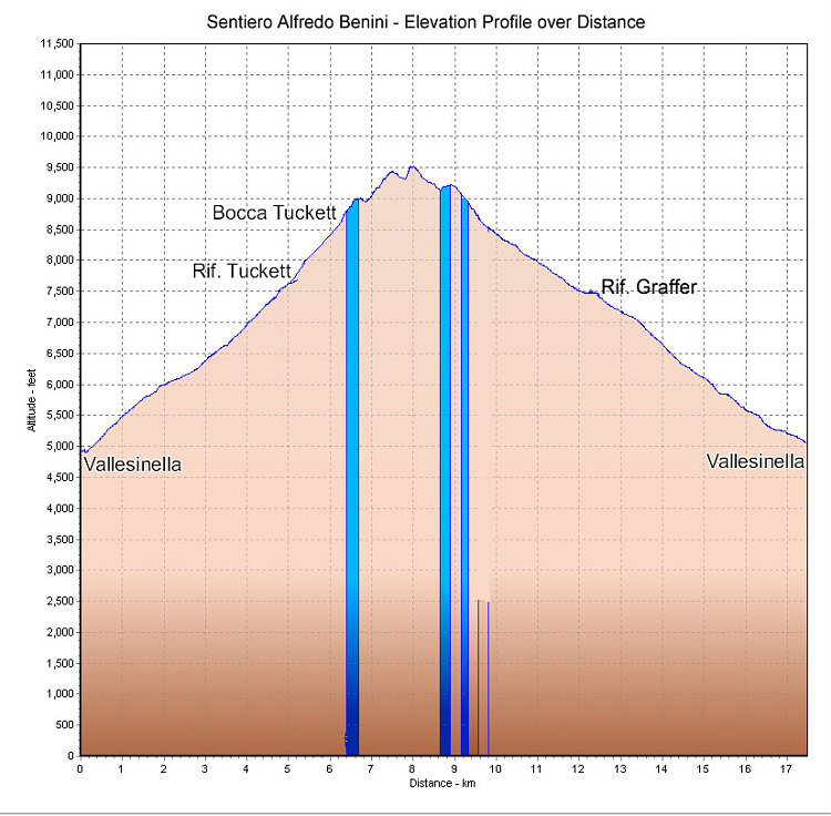
This is a GPS-derived elevation profile of a loop outing involving the Sentiero Alfredo Benini (aka BREN1 in the fletcher / smith guidebooks). The start and end point of the loop is the upper Vallesinella parking lot.
This image is from the presentation "Via Ferrata - Protected Climbing Paths in the Dolomites - Sentiero Alfredo Benini".
 Back to presentation.
Back to presentation.
Copyright 2001-2016 alavigne.net.