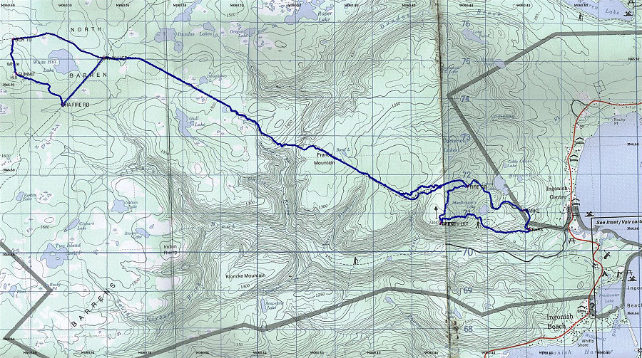
This is a section of 1:50:000 topo map, with the track of our particular journey to White Hill overlain on top.
This image is from the presentation "White Hill - The Highest point in Nova Scotia".
 Back to presentation.
Back to presentation.
Copyright 2001-2016 alavigne.net.