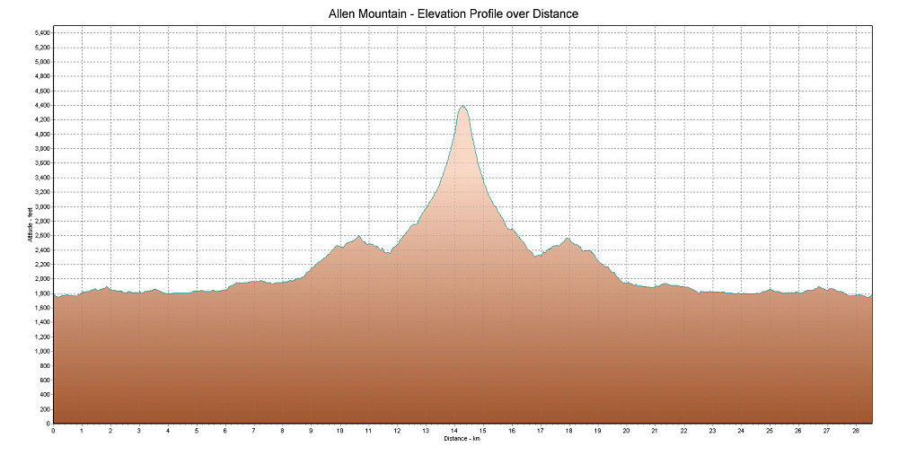
This is a GPS-derived elevation plot of our Allen Mountain hike, graphed over distance.
This image is from the presentation "Mount Allen Winter Climb".
 Back to presentation.
Back to presentation.
Copyright 2001-2016 alavigne.net.