note: you may notice that I'm using the suffix "mountain" when describing Jay in this report. Previously, I had been calling the mountain "Jay Peak". Looking at maps and descriptions, though, revealed that I'd gotten that naming wrong. It is Jay Mountain. Perhaps I was getting it mixed up with Vermont's Jay Peak.
This trip report describes one of the better scenic short hikes of the Adirondacks - Jay Mountain, in the northeastern corner of the high peaks region. I've done trip reports on Jay before, but this one differs in two key respects: firstly, it describes the new official trail that has been built from the road to the ridgecrest, and secondly, it describes the route all the way to the actual summit (in previous trip, I did not go all the way to the official summit).
A number of the attendees of our upcoming 2014 desert southwest trip wanted a limber-up hike - something in the mountains, but something not too long. Jay Mountain was an ideal candidate - moderate in distance and big on views; I'd say that nearly 50% of the entire distance to the summit is either in the open or nearly so. We picked Sunday, September 7 - a beautiful late summer day with cool temperatures, clear air, and bright sunshine.
The new trail, constructed by the NYSDEC in 2012, starts at the intersection of Jay Mountain Road and Upland Meadows Road (in the municipality of Jay). The trail now sports a proper trailhead sign and a section of roadside parking.
Upon entering the trees, the new trail immediately turned right and followed along an old stone wall that ran through the woods. After signing in at the brand-new trail register, it headed off through the woods towards the left (relative to the old trail), soon going through another area of old stone walls (perhaps the remnants of some long-overgrown farm?).
Whereas the old trail led eastward on a ruler-straight course (see the blue line of the old trail in the tracklog), the new trail meandered about, responding to the countours of the hillside and generally trying to find the easiest grade up. Blue NYSDEC trail markers were affixed along the trail.
The trail generally stayed on the northern flanks of Jay Mountain's eastern ridge, up until it neared a forested highpoint along the ridge. It then cut south, through the shallow notch below the highpoint. Here the new trail intersected the route of the old trail. I knew this was roughly the spot where the two crossed, but a cursory glance did not reveal exactly where that was. I'm sure the trail constructors worked hard to camouflage any sign of the old trail in this area. At this point, the new trail has accumulated almost half a kilometer (a third of a mile) more distance than the old trail.
Once through the notch, we descended for a bit as the new trail took a southeasterly course towards the southern flanks of Jay's east ridge. The grade got steeper, but owing to fair bit of trail engineering, several sets of switchbacks - some long and sweeping, some short and tight, never became more than moderately so.
All of the switchbacking and the search for the most advantageous path through the concentrating contour lines resulted in extra distance - distance that those of us who were familiar with the old trail could easily notice. We kept telling Caroline - a first-timer to Jay Mountain - that the first views along the ridgecrest were coming up really soon. But no - more switchbacks and more trees.
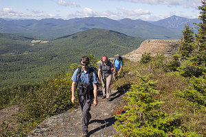
I was a bit disoriented when we finally arrived at the ridgecrest, for we were quite a bit further from where I had expected. Where the old trail had gone straight for the western tip of the ridge, the new trail arrived in a forested notch to the east of the first set of open ledges and rock. Some temporary laminated paper signs directed us in two directions - right for the summit, and left 250 feet to a "lookout" (i.e. one of the open areas that used to be along the path of the old route).

courtesy JInnes
Partly to take a nice cool-off snack break, and partially to visit what we knew was a nice scenic spot, we went left to the lookout. Although the day wasn't that hot, the relative humidity of the cool morning was quite high, and then meant a lot of sweaty clothes. A fresh breeze out in the open did a good job drying all of that off.
The total distance to get to this point along the new trail was nearly 4 km - a fairly sizeable 1.25km (0.75mi) longer than along the old unofficial trail. So, you definitely pay for all of those backs and forths. Is the new trail a lot nicer than the old one? hmmm... hard to say. It isn't that the new trail isn't well-constructed or pleasant to walk on, it's just that I don't recall the old trail being all that bad.
With our cool-off snack break complete, it was now time to introduce Caroline to the good stuff: the mostly-open walk east, along Jay Mountain's ridgecrest.
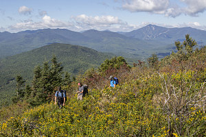
Returning to the junction with the descent trail, we continued east. The blue NYSDEC markers end at this point, but a good footpath is present through the trees, and later - where the route is in the open - there are periodic cairns. After a few minutes, we emerged into and crossed several stretches of knee-high meadow, with very nice views south and west back to the central high peaks. A perfect little earthy footpath cut across each section.
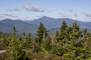
First of Many Ridge Views

courtesy JInnes

courtesy JInnes
Rare Adirondack Meadow-Walking