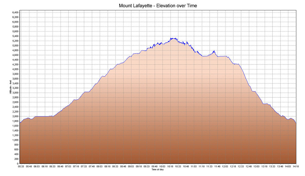
This is a GPS-derived plot of our elevation over time. You may notice that the upper part of the graph is 'jagged'. This appears to be an effect the high winds had on my GPS. Probably the gusty and rapid airflow affected my Garmin 60CSX's baro sensor, causing fluctuations in the altitude reading. I'll have to make sure to keep the GPS' pressure port shielded from the wind next time!
This image is from the presentation "Lafayette on a windy day".
 Go to presentation where this image occurs.
Go to location in presentation where this image occurs.
Go to presentation where this image occurs.
Go to location in presentation where this image occurs.
Copyright 2001-2016 alavigne.net.